Find my route

De Estinnes-au-Mont à Thuin
On Lines 109A and 109/1

Family
")
19 km
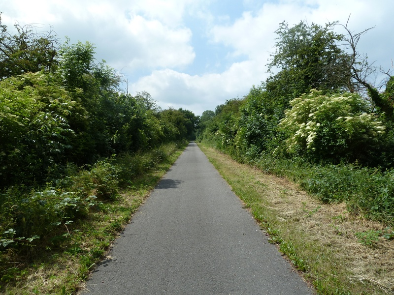
The Line 109A RAVeL seems to be with us for only a short stretch. And yet it is an important link because, ultimately, it will connect the Mons region and the Borinage with Thudinie and the Sambre valley as far as the Botte du Hainaut. And that’s only fitting, because a series of lines join up with this route that now delight RAVeL fans. It gives access to Line 108 to Binche or Erquelinnes, and to Line 109/1 to Lobbes and Thuin.
Line 109/1 alternates through wood and forest. Between farmland, ponds, streams and Pincemaille forest, the RAVeL offers you surprising peace and quiet among several regions given over to industry, carnivals and the busyness of urban life.
Details
The route:
The route follows its own safe path along the RAVeL of Lines 109A, 109/1 and Sambre.
Surface:
Smooth (mostly asphalt).
Height difference:
Flat or imperceptible incline.
Signs:
Full directional signs are in place along the entire route.
Warnings
Useful info
Starting Point (RAVeL Line 109A) :
Rue de la Station in Estinnes-au-Mont.
Coordinates Lambert 72 : X : 130092 m - Y : 119951 m
GPS coordinates: Latitude: 50°23'24.50'' N - Longitude: 4°5'19.60'' E
End of section on the RAVeL of Line 109A and start of section 109/1 :
Rue Charles Gantois in Fauroeulx (near n°37).
Coordinates Lambert 72 : X : 132103 m - Y : 117590 m
GPS coordinates: Latitude: 50°22'08.31'' N - Longitude: 4°07'01.82'' E
End of the stretch 109/1 :
Rue Evelyn Drory in Biel-lez-Happart.
Coordinates Lambert 72: X: 140476 m - Y: 116200 m
GPS coordinates: Latitude: 50°21'24.02'' N - Longitude: 4°14'05.64'' E
Arrival Point (Line 109/2) :
At the beginning of the RAVeL of Line 109/2, at the level crossing between Avenue de la Couture and Rue du Fosteau in Thuin (near the Centre de Découverte du Chemin de Fer Vicinal tram centre.).
Coordinates Lambert 72: X: 143650 m - Y: 114580 m
GPS coordinates: Latitude: 50°20'31.75 "N - Longitude: 4°16'46.31 "E
Access by train: Thuin Belgian railway station.
Parking: Many parking possibilities nearby.
Guides/maps:
- RAVeL map of the Province of Hainaut published by the SPW. This map, called ‘More RAVeL, more pleasure, can be ordered free of charge by clicking here.
Around the route by bike:
- Hainaut by bike – Hainaut Rando routes.
Stage map