Find my route

From Waimes to Losheimergraben (Büllingen/Bullange)(stage 2)
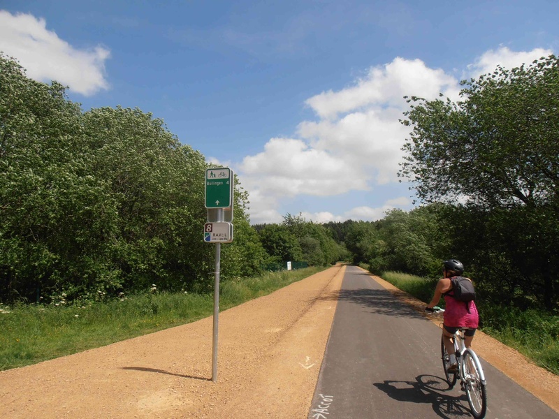
On the RAVeL of Lines 48 and 45A

Family
")
25 km
This stage takes you right into the East Cantons. You start from Waimes, the most eastern French-speaking commune.
First you follow a stretch of the famous Vennbahn (Line 48) between Waimes and Weywertz. After this, on the Line 45A RAVeL in Bütgenbach, you go alongside the reservoir lake of the Warche river and pass by the Worriken tourist and leisure centre.
Your trip continues towards Bullange/Büllingen, with magnificent views over the surrounding bocages. Just after the village of Honsfeld, you will find typical landscapes of the Hautes Fagnes nature reserve, alternating between peat bogs, heaths and forest with fairly outstanding flora and fauna.
Near the site of the old Bücholz railway station, you will have the chance to explore some remains of the railway heritage. Finally, an impressive stretch takes you to the end of this stage, just beneath a viaduct at the border, near Losheimergraben, one of the highest villages in Belgium. The climate here is harsh and cold in winter, so cross-country skiing is regularly possible on the RAVeL.
Details
The route + surface information:
This stage follows its own safe path on two parts of the RAVeL. Between Waimes and Weywertz, you go along the Line 48 - Vennbahn RAVeL for 7 kilometres and between Weywertz, Bütgenbach, Worriken, Bullange/Büllingen, Honsfeld, Buchholz and Losheimergraben, you are on Line 45A for 18 kilometres.
You can continue your route in Germany on the Line 45A greenway which takes you along an 18-km stretch as far as Jünkerath, where a German railway station is in service. You then follow the German cycling route called the ‘Kyll-Radweg’ which ends in Trèves/Trier.
Height difference:
Ascent of 227 metres. Imperceptible incline.
Signs:
Full directional signs are in place along the entire route.
Warnings
Useful info
Start:
Rue du Centre (N632) in Waimes.
Coordinates Lambert 72 : X : 273869 m - Y : 124217 m
GPS coordinates: Latitude: 50°24'56.65'' N - Longitude: 6°06'42.42'' E
Access by car: easy parking nearby.
Arrival:
Belgian-German border, near Losheimergraben, under the bridge over road 265.
Coordinates Lambert 72 : X : 291951 m - Y : 119349 m
GPS coordinates: Latitude: 50°22'04.40'' N - Longitude: 6° 21' 51.38''
Guides/maps:
- RAVeL map of the Province of Liège published by the SPW. This map, called ‘More RAVeL, more pleasure’, can be ordered free of charge by clicking here.
- Map to a scale of 1/100,000 available from the ATEB detailing the route of the various sections of the RAVeL in the East Cantons.
Around the route by bike:
Stage map