Find my route

De Leers-Nord (Estaimpuis) à Tournai (stage 1)
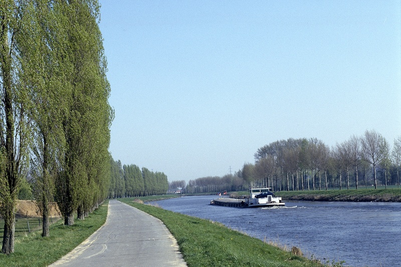
On the RAVeL of the Espierres canal and the Scheldt

Family
")
23 km
This journey starts at the Maison du Canal coffee shop on the Espierres canal in Leers-Nord. Coming from Roubaix, one of the textile capitals of the world in the early 20th century, this entrance to the ‘Plat Pays’ along the left bank of the canal is a real picture postcard. The long lines of trees along the banks of waterways in Flanders against a background of bell towers are typical of landscapes featuring a canal. This canal, which fell into disuse in 1985, was listed as part of Walloon heritage in the year 2000. When you reach Espierres-Helchin/Spiere-Helkijn, you leave it behind and join the Scheldt RAVeL.
Here you can’t help but notice that the peace and quiet of a preserved canal is at an end and the waterway traffic becomes heavier. The scenery around you gradually changes. The atmosphere becomes more industrial.
You reach the Kain lock and go off to explore one of Belgium’s oldest cities, crossing the famous Pont des Trous (Bridge of Holes). Tournai, known not least as the cradle of French royalty as a certain Clovis was born here, is a real museum city. You can visit the cathedral and its treasure, included on the UNESCO World Heritage List, the Fine Arts museum created by Horta and much more besides.
Details
The route:
The route runs largely along the RAVeL of the Espierres canal and the Scheldt.
Surface:
Smooth (alternately asphalt and concrete).
Height difference:
Flat or imperceptible incline.
Signs:
Full directional signs with W4 identification panels are in place.
Safety, precautions:
Watch out for the alternating separate paths and loading quays near industrial zones.
Connection:
Route shared with the EV5 international route as far as the bridge over the Espierres canal in Espierres-Helchin/Spiere-Helkijn.
Warnings
Useful info
Start:
Leers-Nord lock, rue du Canal in Leers-Nord (Estaimpuis).
Coordinates Lambert 72 : X : 71456 m - Y : 153964 m
GPS coordinates: Latitude: 50°41'27.51" N - Longitude: 3°15'25.51" E
Access by train:
- From Estaimbourg railway station, which lies about five kilometres to the south of the starting point, take the N510 towards Pecq for about 600 metres. Then take the first left towards Leers-Nord. Follow nodal points No 45, 36, 34, 32 and 30.
- As you leave Herseaux railway station, which lies about 6.5 kilometres to the north of the starting point, head towards the level crossing on the N512 (chaussée d’Estaimpuis). Turn left and carry on for just over 300 metres, then take the 3rd right (to the right at the crossroads with traffic lights). Then follow nodal points No 29, 33, 34, 32 and 30.
Parking: large car park near the starting point.
Rest area:
In Warcoing (at NP No 48), just before Pecq, near the Kain lock.
Car parks along the route:
- Hérinnes, Barrage: 8 places, including for people with reduced mobility
- Pecq, Route Fluviale: 6 places
- Tournai, Rivage du Pontonnier: 12 places
Guides/maps:
- RAVeL map of the Province of Hainaut published by the SPW. This map, called ‘More Ravel, more pleasure’, can be ordered free of charge by clicking here.
- Maps of West and East Wallonie picarde (Western Hainaut) by bike: wapishop.be.
Around the route by bike:
- Wallonie picarde (Western Hainaut) by bike: www.wapinature.be/-A-velo-.html.
- Hainaut by bike – Hainaut Rando routes: www.hainauttourisme.be/loisirs-et-activites/itineraires-thematiques/.
Stage map