Find my route

De Liège à Huy (stage 3)
On the Meuse RAVeL and connecting cycle paths

Medium
")
36 km
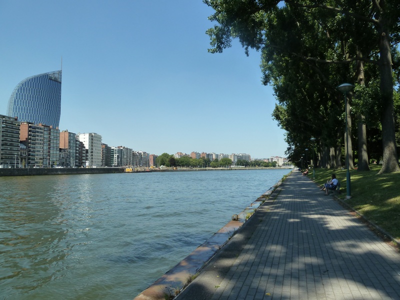
As you head out of Liège on the Quai du Condroz in Angleur, you leave behind you the RAVeL on the left bank of the Ourthe to go towards the Meuse and the future Cité des Métiers (careers advice centre) on the site of Val Benoît. A little further on, you go past the Standard de Liège football stadium.
The Val Saint Lambert glassworks lies on the edge of Seraing, a city surrounded by metalworking sites, former flagships of the Liège economy. It consists of the castle and its old Cistercian abbey built during the 13th century. You have the opportunity to visit the famous Val Saint Lambert glassworks which boasts a long and internationally renowned industrial past.
A good ten kilometres further on you will see on your right the towers of the Amay collegiate church dating from the 7th century and in front of you stand the cooling towers of the Tihange nuclear power plant.
As soon as you enter the beautiful old city of Huy with its rich historical heritage, arriving beneath the headland on which the Citadel stands, you will have but one thought in mind: to find the famous ‘wall’, the steep climb that puts such a strain on the calves of racing cyclists!
Details
The route:
You start this stage on the Quai du Condroz in Angleur, on the left bank of the Ourthe. You head towards rue du Biez on a short connecting stretch towards the Ourthe Canal RAVeL. This takes you close to the Meuse river which you cross using a footbridge adjoining the railway bridge. This footbridge is just before the cable-stayed bridge over the Meuse.
The directional signs indicate that you should continue towards Seraing and Huy along small local roads. These roads are a little way from the left bank of the Meuse and wind their way through the districts of Val Benoît, Sclessin and Tilleur.
Just before Jemeppe, you cross the Seraing bridge to the right bank of the Meuse. Having gone through the city on well signposted municipal roads, you will return to the RAVeL on its own path until the site of the Tihange nuclear power plant. You reach the centre of Huy via a well signposted connecting link along municipal roads.
Surface:
Mainly smooth. Alternately asphalt and concrete.
Height difference:
Flat.
Signs:
Full directional signs with EV3 identification panels are in place.
Safety, precautions:
Between Liège and Seraing, the route mostly runs along local roads where the traffic is light to moderate and not particularly fast, but which do not have any cycle paths (± 7 kilometres on shared roads).
Connections:
- Stage shared with The Meuse by bike international route and the W6 regional route (Along the water).
- In Jemeppe-sur-Meuse, which lies opposite Seraing, you can join the RAVeL of Lines 212 and 210 towards Montegnée and Ans.
- In Huy, you can join the Line 126 RAVeL towards Ciney.
- In Huy, by taking the Meuse RAVeL along the left bank towards Statte and Wanze, you will also be able to reach the Line 127 RAVeL in Huccorgne, heading towards Braives, Hannut and Landen. To do this, you will need to go through the centre of Wanze, follow the N64 for a while and then take rue Val Notre Dame and the N652 for two kilometres (heavy traffic).
Warnings
Useful info
Start:
Quai du Condroz 27-29, 4031 Angleur (Liège), along the Ourthe river opposite the Gramme school, not far from the Fétinne/Fragnée bridge and the Belle-Île shopping centre.
Coordinates Lambert 72 : X : 236260 m - Y : 146122 m
GPS coordinates: Latitude: 50°37'9.75 "N - Longitude: 5°35'15.88 "E
Access by train: Liège-Guillemins Belgian railway station.
Parking possible near the starting point.
Guides/maps:
- RAVeL map of the Province of Liège published by the SPW. This map, called ‘More RAVeL, more pleasure’, can be ordered free of charge by clicking here.
Stage map