Find my route
De Namur à Charleroi (stage 5)
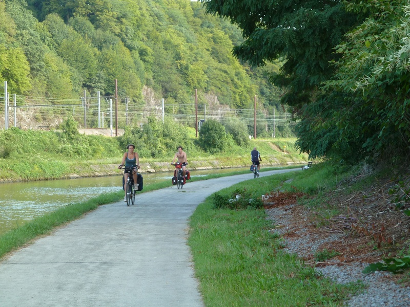
On the Sambre RAVeL

Family
")
47,5 km
Leaving Namur, the route of this stage, which follows its own path, runs through a wide variety of superb landscapes. You go along the RAVeL beside the Sambre, a calm, winding river. A series of locks and bridges lie in the heart of the countryside.
The RAVeL will reveal a landscape of transition, sometimes rural, such as near Floreffe Abbey, sometimes post-industrial when you cross the Lower Sambre and enter the greater Charleroi area. Upon your arrival, be sure to visit the Bois du Cazier site, a symbol of the region’s coal-mining past, both rich and painful.
Details
The route:
From the starting point at the Quai de l’Ecluse in Namur, you follow the Sambre RAVeL throughout this stage.
Surface:
Smooth, mostly asphalt.
Height difference:
Flat.
Signs:
The entire stage is marked by specific ‘EV3 – Sambre RAVeL’ directional signs.
Safety, precautions:
Beware of motor traffic when crossing from one bank to the other over the Tamines bridge.
Warnings
Useful info
Start:
Crossroads between the Quai de Sambre and the alley overlooking Place Maurice Servais and Rue des Brasseurs in Namur.
Coordinates Lambert 72: X: 185244 m - Y: 127993 m
GPS coordinates: Latitude: 50°27'42.15" N - Longitude: 4°51'54.45" E
Access by Train: Namur SNCB railway station.
Parking possible.
Guides/maps:
- RAVeL maps of the Provinces of Namur and Hainaut published by the SPW. These maps, called ‘More RAVeL, more pleasure’, can be ordered free of charge by clicking here.
Stage map