Find my route
De Thuin à Maubeuge (F) (stage 7)
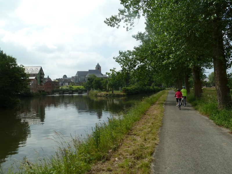
On the Sambre RAVeL

Family
")
19,5 km
From Charleroi onwards, the industrial sites along the Sambre RAVeL quickly give way to pastoral landscapes. The Sambre becomes wilder, with a variety of fauna and flora. Your route takes you past a series of picturesque locks, designed to accommodate the old barges which were once built in the region’s various shipyards.
The constant presence of pleasure craft shows that Thuin, famous for its hanging gardens, was and still is a riverboat centre.
Details
The route:
From the starting point at the Quai de Flandre opposite Charleroi railway station, you follow the Sambre RAVeL throughout the stage.
Surface:
Smooth (mostly asphalt).
Height difference:
Flat.
Signs:
The entire stage is marked by specific ‘EV3 – RAVeL Sambre’ directional signs.
Safety, precautions:
Beware of motor traffic when going from one bank to the other across the Olof Palme bridge in Charleroi and the Marchienne-au-Pont bridge.
Warnings
Useful info
Start:
Quai de Flandre 6000 Charleroi.
Coordinates Lambert 72 : X : 155000 m - Y : 121690 m
GPS coordinates: Latitude: 50°24'21.90 "N - Longitude: 4°26'20.69 "E
Access by train: SNCB Charleroi-Sud railway station.
Guides/maps:
- RAVeL map of the Province of Hainaut published by the SPW. This map, called ‘More RAVeL, more pleasure’, can be ordered free of charge by clicking here.
Stage map