Find my route
De Dinant à Marche-en-Famenne (stage 6)
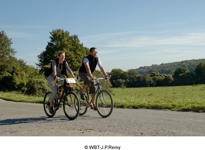
On the minor roads of the Condroz and the Famenne regions

Medium
")
48,5 km
In the Meuse valley, the path follows a gentle incline for about 10 km alongside the charming Fonds de Leffe nature reserve between steep rocky hillsides. You head towards the Condroz plateau along quiet little roads.
You pass successively through the beautiful villages of Thynes and Sovet, characterised by limestone dwellings typical of the region. The route also gives you an opportunity to admire Leffe abbey, Chession castle and Lisogne mill.
Having left the town of Ciney behind, you go through the authentic villages of Leignon and Humain. The route leads you from the Condroz to the Pays de Famenne region, the ideal setting for cycling along greenways and country roads. From the lively town of Marche-en-Famenne, a network covering 350 kilometres of waymarked paths with nodal points (NP) and custom-made routes enables you to explore rural landscapes and enjoy relaxing in the open air.
Details
The route:
Having crossed Bouvignes lock and taken the N948 road for a few hundred metres following the signs (panels with green background), you turn right along a secondary road towards Thynes, Sovet and Ciney.
After Ciney, you follow quiet little roads where the traffic is usually light but which are not signposted/waymarked. You cross through the villages of Pessoux, Haversin, Havrenne and Humain to reach the Pays de Famenne region and the nodal-points network which starts just before Humain, at NP 34 (chemin Saint-Rémy). From here, directional signs guide you to Marche-en-Famenne.
You enter Marche-en-Famenne entirely on a greenway with its own path integrated into the urban road.
Surface:
Smooth (concrete or asphalt).
Height difference:
Hilly route with moderate inclines, usually less than 3%.
Signs:
Directional signs with EV5 identification panels are in place along the entire route.
Safety, precautions:
This stage consists mainly of stretches along quiet roads but caution is nevertheless required.
Connections:
- In Ciney, you can join the Line 126 RAVeL following the signs to Huy.
- In Humain, the signs indicating the ‘Dorsale du Pays de Famenne’ prompt you to turn towards Rochefort in the direction of the Line 150B RAVeL which leads to Houyet.
Warnings
Useful info
Start:
Bouvignes-sur-Meuse lock, avenue Colonel Cadoux in Dinant (left bank of the Meuse).
Coordinates Lambert 72 : X : 188173 m - Y : 106400 m
GPS coordinates: Latitude: 50°16'2.64'' N - Longitude: 4°54'15.04'' E
To reach the start from the centre of Dinant: cross the Dinant bridge and follow the Meuse along the left bank for about one kilometre as far as the Bouvignes lock
Access by train: Dinant Belgian railway station.
Finish:
Marche-en-Famenne, NP 27, at the roundabout at the end of boulevard du Nord. Opposite the Tourist Office in place de l’Étang.
Coordinates Lambert 72 : X : 219576 m - Y : 102526 m
GPS coordinates: Latitude: 50°13'46.90'' N - Longitude: 5°20'38.04 '' E
To reach the centre of the old town: when you get to the roundabout, follow the direction of NP 24 taking the first right, rue Porte Basse.
To return or continue by train: Marche-en-Famenne Belgian railway station is one kilometre away.
Rest areas:
- Just before reaching the village of Thynes.
- In the place called Plateau du Gerny (km 40.80): shelter and lovely panoramic view.
Guides/maps:
- RAVeL maps of the Provinces of Namur and Luxembourg published by the SPW. These maps, called ‘More RAVeL, more pleasure’, can be ordered free of charge via the RAVeL website by clicking here.
- Map of the Pays de Famenne region by bike (nodal points), distributed by the Tourist Offices.
Around the route by bike:
- Pays de Famenne region by bike: www.famenne-a-velo.be
Stage map