Find my route
De Namur à Dinant (stage 5)
On the Meuse RAVeL

Family
")
27 km
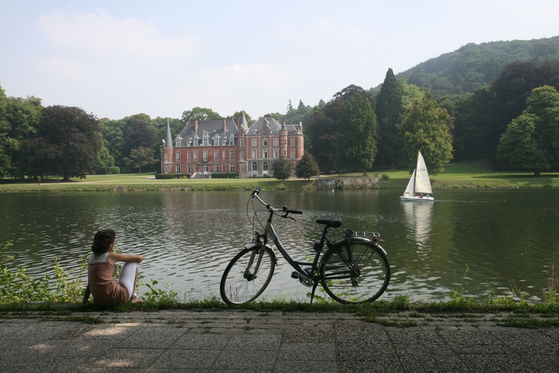
As you leave Namur, you are enveloped by the relaxing atmosphere of the Meuse RAVeL. You pass through the village of Wépion, recognised the world over for its strawberries. You gradually enter the most beautiful part of the Meuse valley with its many cliffs and superb sites such as the famous Annevoie gardens.
When you reach Rivière, look up. You may see those daredevils of the skies, hang-gliders, launching themselves from the top of the Sept Meuses beauty spot. Just after Anhée, you will see the ruins of the feudal castle of Poilvaches overlooking the Meuse from their rocky spur.
As you approach Dinant, you will see several hectares of vines lining the hillside. At the foot of the citadel, on the quaysides along the Meuse, the town of the Copères (as the people of Dinant are known) tempts your taste buds and invites you to savour its famous couques (honey biscuits) or enjoy a boat trip.
Details
The route:
The entire stage runs along its own RAVeL path. It starts on the Grognon site at the foot of the citadel, at the confluence of the Sambre RAVeL and the Meuse RAVeL. Go down the ramp to the RAVeL on the right bank of the Sambre. After 100 metres, you reach the Meuse RAVeL. Follow the Meuse on the left bank to Dinant.
Surface:
Mainly smooth. From Namur to Anhée, alternating asphalt and passable cobblestones. Note that at the Houx lock, the surface changes from asphalt to fine dolomite rock for three kilometres.
Height difference:
Flat.
Signs:
Full directional signs with EV5 identification panels are in place.
Connections:
- In Namur, connections with the EV3 international route and with the W6 regional route, either towards Charleroi or towards Huy and Liège.
- From Namur, stage shared with the W5 regional route as far as the Bouvignes-sur-Meuse lock.
- Between La Plante lock in Namur and the Bouvignes-sur-Meuse lock (approximately one kilometre before Dinant), the stage is shared with The Meuse by bike international route.
- As you leave Anhée, you can join the Line 150A RAVeL (Molignée valley) towards Maredsous, Fosses-la-Ville and the Sambre valley. Line 150 is part of the W4 regional route.
- Just before Dinant, at the Bouvignes lock, The Meuse by bike route and the EV5 route separate. The Meuse by bike continues straight on towards Dinant. If you cross the lock, you follow the EV5 towards Ciney.
Warnings
Useful info
Start:
Namur (right bank of the Sambre), in the place called Le Grognon, rue du Grognon.
Coordinates Lambert 72: X: 185498 m - Y: 128001 m.
GPS coordinates : Latitude : 50°27'42.35 "N - Longitude : 4°52'7.33 "E.
Access by train: Namur Belgian railway station.
Access by car: parking spaces available on site.
Finish:
Bouvignes-sur-Meuse lock, avenue Colonel Cadoux in Dinant (left bank of the Meuse).
Coordinates Lambert72 : X : 188173 - Y : 106400
GPS coordinates: Latitude: 50°16'2.64'' N - Longitude: 4°54'15.04'' E
To go to the centre of the town upon arriving: Go along the Meuse following the RAVeL on the left bank.
To return or continue by train: Dinant railway station. Go along the Meuse following the RAVeL on the left bank for approximately one kilometre. Just before the bridge, turn right twice. The railway station is in front of you to the left.
Rest areas:
- La Plante park in Namur.
- Promenade de Meuse in Wépion.
Guides/maps:
- RAVeL map of the Province of Namur published by the SPW. This map, called ‘More RAVeL, more pleasure’, can be ordered free of charge by clicking here.
Around the route by bike:
- The Pays de Namur region by bike: www.paysdenamur.be.
- Anhée VeloTour: www.meusemolignee.be.
Stage map