Find my route
De La Roche-en-Ardenne à Bastogne (stage 8)
From La-Roche-en-Ardenne to Bastogne (stage 8)

Medium
")
46 km
With a last look back at the mysterious La Roche, you head off through steep-sided valleys and wooded hills towards Erneuville and its vast grassy plateaux. You follow a pleasant route with a gentle slope along the delightful Ry de Bronze. You cross a multitude of picturesque villages with charming names such as Grainchamps, Tresfontaines, Wyompont, Ortheuville, Lavacherie or Amberloup. Sometimes perched on Ardennes ridges, sometimes nestling at the bottom of the western Ourthe valley, you will love these quiet, rustic places.
Leaving the green and peaceful commune of Sainte-Ode behind, you climb a gentle slope towards the Bastogne plateau following the lovely Laval valley and its tributary streams. In Sibret, where you reach the plateau, you will be able to follow a stretch of the pre-RAVeL along the old No 163 railway line to Bastogne, a town famous for the Battle of the Bulge. Shops, museums and other memorials are just waiting for you to visit... If you are in the area in April, be sure to go and watch the athletes pass by in quest of victory in the Liège-Bastogne-Liège cycle race.
There’s no doubt that you will retain a lasting memory of this stage.
Details
The route:
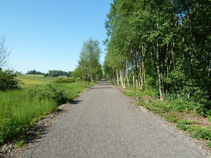
The route runs mainly along quiet minor roads, away from motor traffic. It ends with a short stretch on the Line 163 pre-RAVeL. Like the route of the EV5, this stage usually ends in the hamlet of Isle-le-Pré, just before Bastogne. We have carried it on as far as the old Bastogne-Sud railway station, which you can reach by continuing along the pre-RAVeL for about 1.8 kilometres.
Surface:
Smooth (mostly asphalt), except on the Line 618 and 163 pre-RAVeL (uneven, made of compacted gravel).
Height difference:
The height difference is relatively large (+ 679 m, - 377 m), but it is spread over 46 kilometres and should not make you shy away given the careful choice of routes with very slight inclines.
Signs:
Specific EV5 directional signs are in place along the entire route.
Connections:
- Route shared with the W7 regional route between La-Roche-en Ardennes and Amberloup.
- In Bastogne, connection with the W9 regional route towards Martelange on the one hand and with the Line 163 RAVeL towards Gouvy on the other.
- In Bastogne, connection possible with the Line 164 RAVeL towards Wiltz and the Grand Duchy of Luxembourg.
Warnings
Useful info
Start:
Place du Bronze in La-Roche-en-Ardenne.
Coordinates Lambert 72 : X : 236226 m - Y : 97237 m
GPS coordinates: Latitude: 50°10'47.81'' N - Longitude: 5°34'33.67'' E
Access by car: Pay car park in the centre of La Roche. Head away from the centre to find free parking.
Finish:
Old level crossing on Line 163, rue Isle-le-Pré in Bastogne.
Coordinates Lambert 72 : X : 244912 m - Y : 76203 m
GPS coordinates: Latitude: 49° 59' 22.32'' N - Longitude: 05° 41' 32.49'' E
To the centre of the town upon arriving: continue on Line 163 for just over 1.8 kilometres to the old Bastogne-Sud railway station. Go round the station and into avenue de la Gare. Leave a one-way street to the left. Two hundred metres further on, turn left into rue de Neufchâteau (beware of the traffic). The centre is 250 metres away.
Rest areas:
Wyompont, Lavacherie, Fosset, Laval, Bastogne.
Guides/maps:
- RAVeL maps of the Provinces of Luxembourg published by the SPW. These maps, called ‘More RAVeL, more pleasure’, can be ordered free of charge via the RAVeL website by clicking here.
Stage map