Find my route
De Houyet à Jemelle (Rochefort)
On the Line 150 RAVeL

Family
")
21,5 km
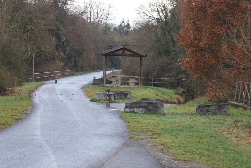
Your guiding thread along this route is La Lesse, a winding river which has hollowed out a valley that is remarkable for more than one reason. From Houyet, you will cross this river several times. You penetrate right into the bowels of the rock through the Hour tunnel, which is over 400 metres long. You explore the Collyre path in the state-owned forest of Ciergnon, at the foot of the Château Royal.
The many rest areas along the riverbank invite you to picnic around the barbecues provided or dip your feet lazily in the invigorating current. Rochefort, a friendly city, by the way, is just waiting to have you taste its local products, including its famous Trappist beer. You finish your outing in peace and quiet by crossing the wood to Jemelle.
Details
The route:
The route follows its own safe path on the RAVeL, except along a short stretch in the centre of Rochefort.
Surface:
Smooth, asphalt.
Height difference:
Imperceptible incline.
Signs:
Full directional signs are in place along the entire route.
Connections:
In Rochefort, to the left as you come out of the tunnel, you can reach the village of Humain, Marloie railway station and the RAVeL between Marche-en-Famenne and Hotton via a connecting route that stretches 18 kilometres, following the directional signs put in place by the Pays de Famenne region (‘La Dorsale du Pays de Famenne’).
Warnings
Useful info
Start:
Start from the beginning of the RAVeL, rue de la Station (N929), just next to the railway station (after the level crossing coming from the station).
Coordinates Lambert 72 : X : 195583 m - Y : 97741 m
GPS coordinates: Latitude: 50°11'20.49" N - Longitude: 5°0'25.43" E
Access by train: Houyet Belgian railway station.
Access by car: Parking nearby.
Arrival point:
Belgian railway station car park at the end of rue des Marchandises in Jemelle.
Coordinates Lambert 72 : X : 214092 m - Y : 94643 m
GPS coordinates: Latitude: 50°09'34.02" N - Longitude: 5°15'56.56" E
Rest areas:
There are several rest areas along the way.
Guides/maps:
- RAVeL map of the Province of Namur published by the SPW. This map, called ‘More RAVeL, more pleasure’, can be ordered free of charge by clicking here.
Around the route by bike:
• The Famenne region by bike: www.famenne-a-velo.be.
• The Lesse Valley by bike: www.valdelesse.be.
Stage map