Find my route
De Gouvy (Haie de Bellain) à Bastogne (stage 1)
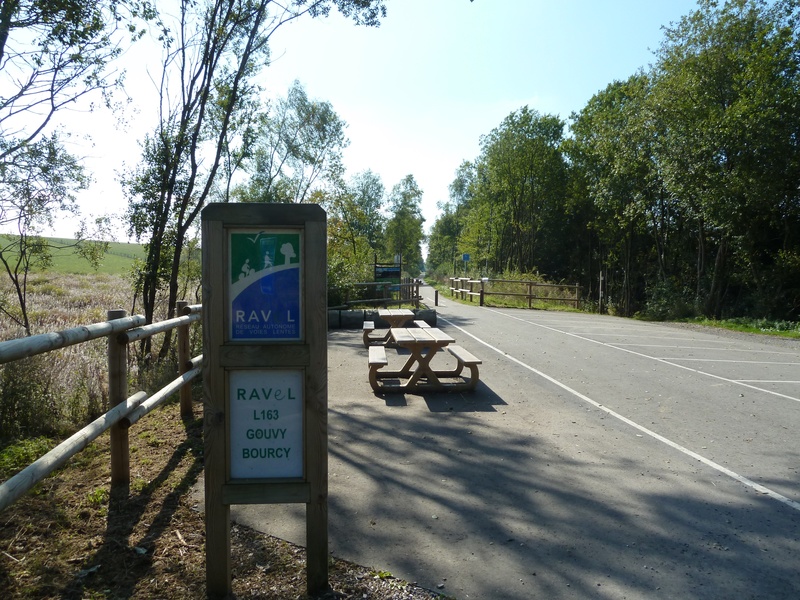
On the Line 163 RAVeL

Family
")
27,5 km
The route is set out entirely along the old No 163 railway line. You go deeper into this green lung, the Belgian Ardennes, in peace and quiet and in total safety. First of all, you cross through thick forests of deciduous and evergreen trees.
At around kilometre 11, a ridge marks the watershed between the basins of the Meuse and the Rhine. You are overlooking the Europe of the rivers…
Carry on along your route on high farmland plateaux dotted with imposing farms to Bourcy, a quiet village at an altitude of 500 metres. From there, still sheltered by the RAVeL, you can reach Bastogne, the Belgian town most well known in the USA, because this is where a handful of GIs withstood the German offensive in the winter of 1944. Museums and other memorials are just waiting for you to visit...
Ah! One more thing! If you are in the area in April, go and watch the athletes pass by in quest of victory in the Liège-Bastogne-Liège cycle race.
Details
The route:
Follow the Line 163 RAVeL on its own safe path to Bastogne.
Surface:
Smooth (asphalt).
Height difference:
Flat (max. 1.2%).
Signs:
The Line 163 RAVeL has full directional signs with identification plates.
Panels bearing the 112 number to call in case of accident and indicating the kilometre of the railway line at this point can be found every kilometre.
Warnings
Useful info
Start:
Gouvy, the place called ‘Haie de Bellain’, rue du Wago. Parking area at the start of the Line 163 RAVeL to Bastogne.
Coordinates Lambert 72 : X : 263640 m - Y : 96799 m
GPS coordinates: Latitude: 50° 10' 17'' N - Longitude: 05° 57' 35'' E
Access by car: E25 junction 51, then N827 to Gouvy. At the entrance to Gouvy, by the church, go downhill on the right and then turn left by a chapel. The RAVeL car park is two kilometres away along rue du Wago.
Access by train: Gouvy railway station on the Liège-Luxembourg line. Opposite the station, follow the directional signs indicating Bastogne and Saint-Vith. The RAVeL is 2.2 km away.
Finish:
Old Bastogne-Sud Belgian railway station, place de la Gare.
Coordinates Lambert 72 : X : 246142 m - Y : 77378 m
GPS coordinates: Latitude: 49° 59' 59'' N - Longitude: 05° 42' 35'' E
Go to the centre of the town upon arriving: With your back to the railway station, take the avenue de la Gare opposite, leave a one-way street on the left (or push your bike for 350 metres). Two hundred metres further on, turn left into rue de Neufchâteau (beware of traffic). The centre is 250 metres away with shops and tourist Office.
Rest areas:
There are several rest areas along the way.
Guides/maps:
- RAVeL map of the Province of Luxembourg published by the SPW. This map, called ‘More RAVeL, more pleasure’, can be ordered free of charge by clicking here.
Around the route by bike:
- The heart of the Ardennes by bike.
- The Pays de Bastogne region by bike.
- The Pays de Vielsalm – Gouvy by bike.
- A loop of about 50 km is described in the document: www.chemindurail.be/doc/Fiche_163.pdf
Stage map