Find my route
De Sainte-Cécile (Florenville) à Muno
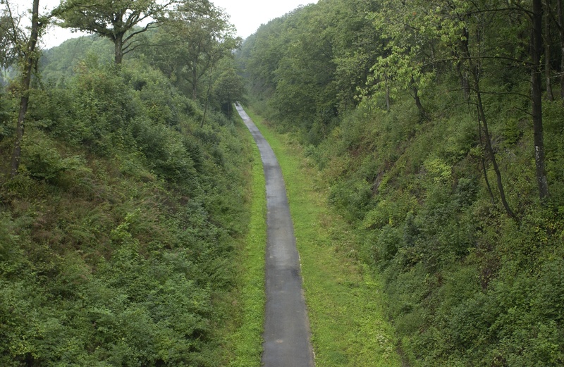
On the Line 165A RAVeL

Family
")
8 km
You travel in the heart of the Pays de la Semois, one of the most beautiful regions in Belgium, along a virtually straight RAVeL. From Sainte-Cécile, you cross a wide wooded expanse, home to game that could surprise you as you go through a grove. If so, make the most of this magical moment when you commune with nature.
You then reach Muno, a small Ardennes village snuggling at the gateway to Gaume, with geological features unique in Wallonia. If you wish, you can extend your walk as far as the French border, not far from the old Muno railway station. Or you can settle down in comfort to savour the region’s famous Trappist beer, Orval.
Details
The route:
The route follows its own safe path on the RAVeL.
Surface:
Smooth, asphalt.
Height difference:
Flat or imperceptible incline.
Signs:
Full directional signs are in place along the entire route.
Connections:
- In Sainte-Cécile, you can join a signposted connecting route along quiet roads towards Chassepierre and Florenville.
Warnings
Useful info
Starting point:
Departure at the site of the former railway station of Saint-Cécile.
Coordinates Lambert 72 : X : 212301m - Y : 46575m
GPS coordinates: Latitude: 49°43'39.03 "N - Longitude: 5°13'58.10 "E
Access by car: parking on site.
Arrival point :
Parking at the former station of Muno.
Coordinates Lambert 72 : X : 207436m - Y : 42947m
GPS coordinates: Latitude: 49°41'43.38 "N - Longitude: 5°09'53.27 "E
Access by car: parking on site.
Guides / maps :
- RAVeL map of the Province of Luxembourg published by the SPW. This map, called "More RAVeL, more pleasure", can be ordered free of charge by clicking here.
Stage map