Find my route
De Saint-Léger à Châtillon
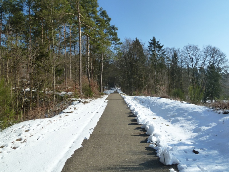
On the Line 615 RAVeL

Family
")
4 km
Your trip through the heart of Gaume starts in Saint-Léger, where bees and their honey are everywhere.
The four kilometres or so between the start and the finish will take you serenely and safely through a pine forest where some of the trees are over a hundred years old.
You end your hike in Châtillon, a village of buildings typical of the region.
Details
The route:
The route follows its own safe path on the Line 615 RAVeL.
Surface:
Smooth concrete.
Height difference:
Flat or imperceptible incline.
Signs:
Old but clearly visible directional signs.
Warnings
Useful info
Starting point:
Rue d'Arlon, 45 in Saint Léger.
Coordinates Lambert 72 : X : 243691 m - Y : 34708m
GPS coordinates: Latitude: 49°37'0.19" N - Longitude: 5°39'54.79" E
Arrival point :
Rue de la Croix in Châtillon.
Coordinates Lambert 72 : X : 246861 m - Y : 36217 m
GPS coordinates: Latitude: 49°37'47.20" N - Longitude: 5°42'34.04" E
Guides / maps :
- RAVeL map of the Province of Luxembourg published by the SPW. This map, called "More RAVeL, more pleasure", can be ordered free of charge by clicking here.
Stage map