Find my route
A Péruwelz
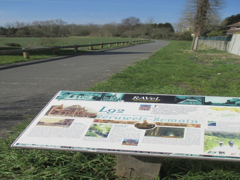
On Line 92

Family
")
2 km
Line 92 starts not far from Péruwelz railway station and heads towards the French border. It will shortly enable everyone to join the Gueules noires greenway in France, going towards Condé-sur-Escaut.
The first part of the route lies in an urban area and is widely used by children, enabling them to get to school in total safety. For that matter, this may be the best contribution a RAVeL can make. Further on, the route follows a more winding path through woods and meadows.
Details
The route:
The route follows its own safe path along the Line 92 RAVeL.
Surface:
Smooth, alternately asphalt and concrete.
Height difference:
Flat.
Signs:
Full directional signs are in place along the entire route.
Connections:
- After Wiers, at the French border, connection to the Gueules noires greenway coming shortly.
Warnings
Useful info
Start:
Rue de la Ferté, 105, Péruwelz.
Coordinates Lambert 72 : X : 94583 m - Y : 133861 m
GPS coordinates: Latitude: 50°30'46.49'' N - Longitude: 3°35'14.61'' E
Access from Péruwelz railway station: As you leave the railway station, turn right into rue des Français and then left into rue de la Verte Louche. Take rue de la Ferté directly on the right and, after 30 metres, you come to the entrance to the RAVeL.
Parking: Small car park not far from the entrance to the RAVeL in rue de la Ferté.
Finish:
Border point at Péruwelz.
Coordinates Lambert 72 : X : 93267 m - Y : 132496 m
GPS coordinates: Latitude: 50°30'01.86'' N - Longitude: 3°34'08.57'' E
Guides/maps:
- RAVeL map of the Province of Hainaut published by the SPW. This map, called ‘More RAVeL, more pleasure, can be ordered free of charge by clicking here.
- Map of West and East Wallonie picarde (Western Hainaut) by bike.
Around the route by bike:
- Wallonie picarde (Western Hainaut) by bike.
- Hainaut by bike – Hainaut Rando routes.
Stage map