Find my route
De Bomal à la Barrière de Petit-Han (Durbuy) (stage 2)
On the Ourthe RAVeL

Family
")
12,5 km
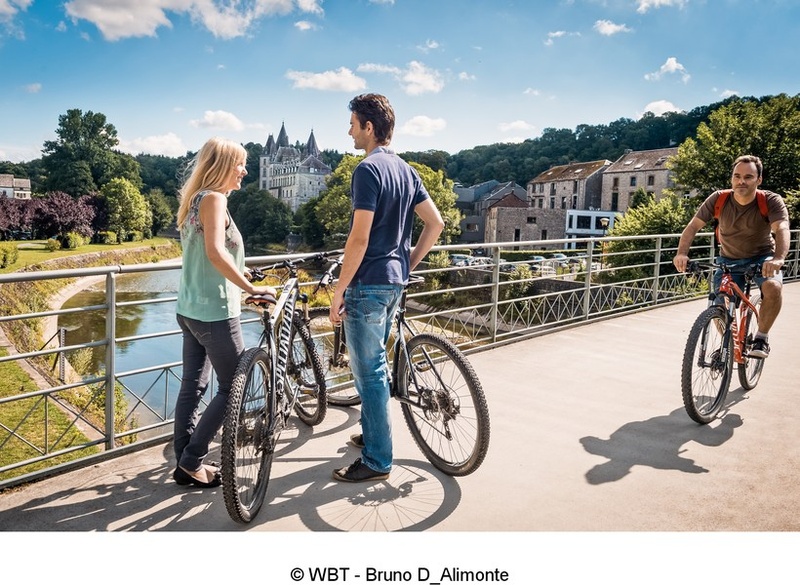
Starting from Bomal, a key spot for kayak enthusiasts, you can enjoy a breath of fresh air along the safe, flat rural path that follows the curves of the Ourthe river. The RAVeL leads you successively to Barvaux, a tourist centre with dwellings typical of the region, well known for its summer maze, and Durbuy, the Pearl of the Ardennes, the final destination of this stage.
Durbuy, considered to be the world’s smallest town, harbours a wealth of heritage with its old 17th- and 18th-century houses and its 11th-century feudal castle.
Details
The route:
The route follows its own safe path along the Ourthe RAVeL.
Surface:
Smooth, alternately asphalt and concrete.
Height difference:
Flat or imperceptible incline.
Signs:
Full directional signs.
Warnings
Useful info
Start:
Rue Pré Cawiai in Bomal, on the left bank of the Ourthe river. Near Bomal railway station and below the bridge over the Ourthe.
Coordinates Lambert 72 : X : 231880 m - Y : 119000 m
GPS coordinates: Latitude: 50°22'34.33" N - Longitude: 5°31'11.67" E
Access by Train: Bomal SNCB railway station just nearby.
Parking possible near the starting point.
Finish:
Barrière of Petit-Han, Rue du Ry de Savon in Durbuy.
Coordinates Lambert 72 : X : 225900 m - Y : 114970 m
GPS coordinates: Latitude: 50°20'26.81" N - Longitude: 5°26'06.12" E
Private café/brasserie car parks at the finish.
Rest areas:
Bomal, Barvaux, Durbuy.
Guides/maps:
- RAVeL maps of the Provinces of Liège and Luxembourg published by the SPW. These maps, called ‘More RAVeL, more pleasure’, can be ordered free of charge by clicking here.
Stage map