Find my route
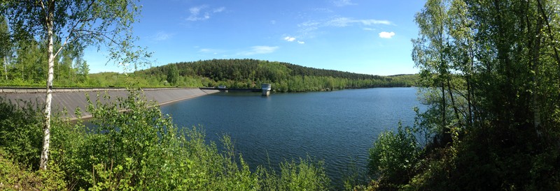
Boucle du Barrage du Ry de Rome
Between the dam and the Bois de Pétigny

Family
")
5 km
Your trip follows a loop in the restful, enchanting setting of the Ardennes massif where you can admire the plant life of the area. While wandering peacefully along the RAVeL, you discover the three rivers that feed the lake - the Ry de l'Hermitage, the Ry de Rome and the Ry des Serpents. Several rest areas set out around the lake provide an opportunity to observe the aquatic life along the edge of this tranquil spot.
Details
The route: The route follows its own path on the RAVeL apart from crossing the dam, when you go along a quiet road.
Surface: Smooth asphalt.
Height difference: Hilly, ascent of 94 metres.
Signs: no signs.
Safety, precautions: Although the route runs along its own path, you should take particular care along the stretch of road when crossing the Ry de Rome dam.
Warnings
Useful info
Start and finish:
Start from the beginning of the RAVeL, right next to the dam and the car park (south of Couvin).
Access by train: Couvin Belgian railway station six kilometres away.
Guides/maps:
- RAVeL map of the Province of Hainaut published by the SPW. The map, called ‘More RAVeL, more pleasure’, can be ordered free of charge by Maps order.
Around the route by bike:
Bike ride in the Vallées des Eaux Vives: www.valleesdeseauxvives.be
Stage map