Find my route
De Dinant à Beauraing(stage 3)
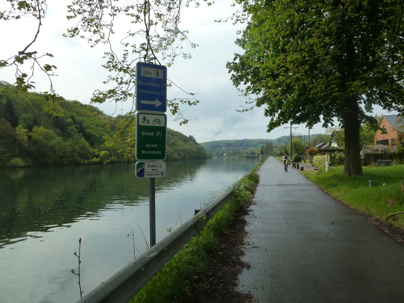
On the RAVeL of the Meuse and of Line 156

Expert
")
42.5 km
Leave Dinant along the RAVeL on the right bank of the Meuse passing below the cliffs of the Bayard rock. As you go round one of the bends in the winding Meuse, the prestigious Freyr castle comes into view, surrounded by its famous gardens and rocks, a mountain climbing centre in Wallonia.
Further downstream, Waulsort castle is also worth a look. Hastière, a typical Mosan village, gives you a chance to unwind.
Shortly after this, you leave the banks of the Meuse and take the RAVeL along the old railway line No 156, where a few elements of railway heritage have been preserved. The old Agimont railway station marks the end of your trip along the RAVeL. The French border and the town of Givet, city of Karel V, are nearby.
In Givet, you join the Lesse & Semois cycle route, which you follow the signs towards the border. You ride on small, quiet roads through the Beauraing countryside.
Details
The route:
You leave Dinant along the RAVeL on the right bank of the Meuse heading towards Givet. When you reach Anseremme lock, you cross the Meuse to the left bank and follow the regional road N96 for about seven kilometres to Waulsort lock (be careful of the traffic). In Waulsort, cross the lock and follow a small local road as far as Pont d’Hastière.
Cross the Meuse again and quickly turn left towards the centre of Hastière. Go into the square in front of the church by turning left then carry straight on towards the old railway line No 156. After a short stretch along this railway line, you are back on the RAVeL on the left bank of the Meuse.
You leave the Meuse at Hermeton-sur-Meuse where you cross the N96 to join the Line 156 RAVeL towards Mariembourg and Givet. At the old Agimont railway station, you leave the RAVeL for good on your left along rue de l’Ancienne Gare. You carry straight on as far as the crossroads with the N908. Then you turn right and follow the N908 for about 150 metres. Then take the greenway on your left. You have just crossed the French border and you are heading towards the centre of Givet (F). From Givet (F), in French territory, you follow the signposting of the Lesse & Semois cycle route in the direction of Fromelennes, then Dion and Beauraing. From the Belgian border, the "W5" route is signposted again.
Surface:
Smooth (mostly asphalt).
Height difference:
Flat.
Signs:
Directional signs are in place along the entire route.
Safety, precautions:
The sections on the regional roads N96 and N908 are dangerous because the traffic is fairly heavy and fast.
Warnings
Useful info
Starting point:
Place Reine Astrid in 5500 Dinant.
Coordinates Lambert 72: X: 188750 m - Y: 105650 m
GPS coordinates: Latitude: 50°15'38.23'' N - Longitude: 4°54'43.89'' E
Access by train: Dinant Belgian railway station.
Rest area:
Waulsort lock
Guides/maps:
- RAVeL map of the Province of Namur published by the SPW. This map, called ‘More RAVeL, more pleasure’, can be ordered free of charge by clicking here.
Stage map