Find my route
De Givet (F) à Dinant (stage 1)
On Line 156 and the Meuse RAVeL

Expert
")
24 km
As soon as you enter Wallonia, you sense the relaxing atmosphere of Line 156 and the banks of the Meuse. On the RAVeL along the old railway line No 156, a few elements of railway heritage have been preserved. The Meuse RAVeL, the main thread along your ride, takes you through Hastière, a typical Mosan village. As you go round one of the bends in the winding river, you see Waulsort castle, not far from the prestigious Freyr castle, surrounded by its famous gardens and rocks, a mountain climbing centre in Wallonia.
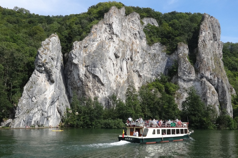
Further downstream, after passing below the cliffs of the Bayard, Dinant and its citadel tempt your taste buds, inviting you to savour the famous couques (honey biscuits) as you enjoy a boat trip on the Meuse.
Details
The route:
Upon leaving Givet, when you enter Belgium, the route turns right on the N908 regional road for 150 metres. By turning left, you then reach the old Agimont railway station and the Line 156 RAVeL, which runs along its own path as far as Hermeton. After a short connecting stretch on local roads, the RAVeL on the left bank of the Meuse takes you to Hastière. You have to cross the bridge and follow a small local road on the right bank of the Meuse to the Waulsort lock. Here you return to the left bank and take the N96 regional road for about seven kilometres to the Anseremme lock. You cross this lock back to the right bank of the Meuse and the RAVeL that leads you to the centre of Dinant.
Surface:
Smooth (mostly asphalt).
Height difference:
Flat.
Signs:
Specific ‘The Meuse by bike’ directional signs are in place along the entire stage. This is very useful, especially for crossing the centre of Dinant and the Meuse at various points.
Safety, precautions:
The sections on the N908 and N96 regional roads are dangerous as the traffic is fairly heavy and fast.
Connections:
- In Givet (F), connection with the Trans-Ardennes greenway towards Charleville-Mézières and Sedan.
Warnings
Useful info
Starting point:
Rue de France at 5544 Heer-Agimont.
Coordinates Lambert 72: X: 181395 m - Y: 93775 m
GPS coordinates: Latitude: 50°09'15.47'' N - Longitude: 4°48'29.00'' E
Access by Train: Givet railway station (France).
Access by car: a few parking spaces near the starting point.
Rest area :
Waulsort lock.
Guides/maps:
- RAVeL map of the Province of Namur published by the SPW. This map, called ‘More RAVeL, more pleasure’, can be ordered free of charge by clicking here.
Stage map