Find my route
De Aix-la-Chapelle/Aachen (D) à Montjoie/Monschau (D) (stage 1)
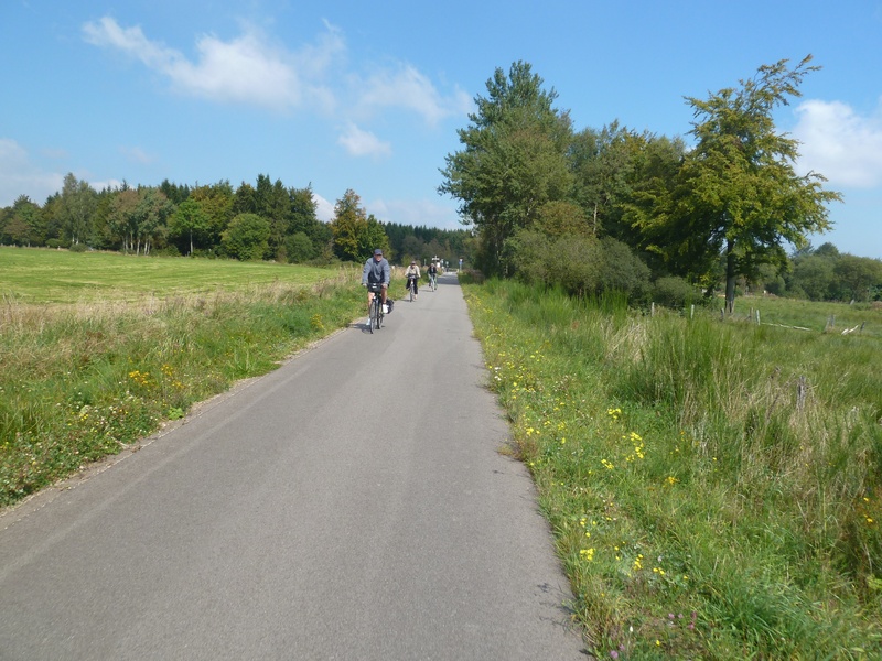
On the Line 48 RAVeL

Family
")
46 km
The Vennbahn route starts in the old imperial city of Aix-la-Chapelle/Aachen in Germany. The busyness and traffic of the city soon give way to the idyllic calm of the surrounding area. The old abbatial city of Kornelimünster awaits visitors in a medieval setting. All along the route, you will come across remains of the railway network, silent witnesses of a glorious past.
The stage continues through meadows and woods until it enters Belgium just before the site of the old Raeren railway station. From here, the Vennbahn passes back and forth from one country to the other as nowhere else. One moment it is in Germany, the next in Belgium. The particular feature of the Line 48 RAVeL is that you are always in Belgium, even though the land on either side of the path is often in Germany.
After Roetgen, the ‘gateway to the Eifel’, the forest is not as dense and heading towards Lammersdorf and Konzen, the landscape reminds some people of Switzerland. Overwhelmed by all these impressions, you reach the old cloth town of Montjoie/Monschau with its many magnificently preserved half-timbered houses.
Details
The route:
From the start in Aix-la-Chapelle/Aachen (D), near Rothe-Erde railway station, the stage runs entirely along its own path on the Vennbahn - Line 48, apart from the connecting section to reach the centre of Montjoie. You go through Aachen-Brand, Kornelimünster, Walheim and Schmithof. After 17 kilometres in Germany, you reach the Belgian border. You then go past the old railway stations of Roetgen, Lammersdorf, Simmerath, Konzen to end in Montjoie.
Surface:
Smooth asphalt except in Paustenbach between kilometres 40.5 and 43.5 where the surface is compacted gravel for environmental reasons.
Height difference:
Flat or imperceptible incline.
Signs:
The entire route is marked by specific Line 48 RAVeL directional signs.
Warnings
Useful info
Start:
S-Bahn station (regional express network) of Aachen-Rothe-Erde. Not to be confused with Aachen Hauptbahnhof, the main railway station.
Trains from and to Liège and Brussels as well as every city in Germany go through Aachen Hauptbahnhof, the main railway station. In Liège, connections are available to all Belgian railway stations, including Troisvierges (end of the Vennbahn, see stage 3).
Distance between Aachen-Rothe-Erde railway station and Aachen Hauptbahnhof main railway station: 2.8 km.
For Rothe Erde railway station:
GPS coordinates: Latitude: 50° 46’ 13.78’’ N - Longitude: 06° 06’ 58.81’’ E
Parking: Apcoa Parkhaus Aachen Arkaden, Trierer Straße 1, 52078 Aachen.
Access to the start of the Vennbahn: Coming from the centre of Aix-la-Chapelle, opposite the entrance to Rothe-Erde railway station (which is underneath the tracks), turn left and then immediately right into a major street (Trierer Straße), go under the railway and then turn left straight away. A ramp leads you to the level of the Vennbahn.
Finish:
Site of the old Montjoie/ Monschau railway station (D).
GPS coordinates: Latitude: 50°33’53.89 ‘’ N - Longitude: 06°14’03 ‘’ E
To go to the centre of the town upon arriving:
If you wish to go to the centre of Montjoie/Monschau (D) from the Vennbahn, find and follow the ad hoc signs. By cycling along the main road for three kilometres (or 1.5 km on foot along a pleasant, steep downhill path), you reach the historic centre (Altstadt).
Rest areas:
Rest areas with shelters can be found all along the path, usually on the site of old railway stations such as in Roetgen.
Guides/maps:
- RAVeL map of the Province of Liège published by the SPW. This map, called ‘More RAVeL, more pleasure’ can be ordered free of charge by clicking here.
- All the documentation can be obtained via the ATEB website (http://www.eastbelgium.com). In particular, a map to a scale of 1/100,000 is available which gives details of the path followed by the Vennbahn and indicates the connections with other RAVeL routes as well as other connections to the German cycling route and greenways network (Radweg).
Around the route by bike:
- VeloTour – Hautes Fagnes–Eifel nodal-points cycling route network: https://www.ostbelgien.eu/fr
- A number of loops use part of the route. These loops are included in a box set called ‘Vennbahn Plus’ which contains an illustrated map of the Vennbahn and a leaflet for each loop with a detailed map and tourist information. https://www.ostbelgien.eu/fr
Stage map