Find my route
De Montjoie/Monschau (D) à Saint-Vith/Sankt-Vith (stage 2)
On the Line 48 RAVeL

Family
")
44 km
Starting from the old Montjoie/Monschau railway station, the way leads you towards the Rur valley in Belgium. A unique area of heath heralds the Hautes Fagnes nature reserve. This fascinating region of raised peat bogs is a huge water reservoir that forces visitors to cross many streams and rivers. Between Kalterherberg (D) and Sourbrodt (B), you will be accompanied by budding railway workers firmly seated on railbikes. (...)
The Vennbahn then goes slightly downhill to the south and crosses an open rural landscape. After Waimes, your route follows the wood known as Wolfsbusch. In Montenau, your nostrils will be assailed by a delicious smell of smoked fresh Ardennes ham, inviting you to linger here. Running partly alongside the Amblève river, the end of your stage leads you down a gentle slope to Saint-Vith/Sankt-Vith, a small but very lively town. At the museum of local life of Saint-Vith, visitors can find out about the eventful past of the Vennbahn.
Details
The route:
From the start at the site of the old Montjoie/Monschau railway station (D), the entire stage runs along its own path on the Line 48 RAVeL – Vennbahn, apart from a short connecting stretch at the entrance to Saint-Vith/Sankt-Vith to reach the end of this stage 2.
Surface:
Smooth (asphalt).
Height difference:
Flat or imperceptible incline.
Signs:
Specific ‘Line 48 RAVeL - Vennbahn’ directional signs are in place along the entire route.
Connection (the kilometres are counted from the starting point):
- In Kalterherberg (D): connection with the Rurufer Radweg (cycling route of the Rour in French/Rur in German/Roer in Dutch, known as the Rur in English) enabling you to follow this river from the Signal de Botrange to the point where it flows into the Meuse in Roermond (NL).
- In Weywertz, you can fork left along the Line 45A RAVeL towards Bütgenbach, Bullange/Büllingen (Line 45a RAVeL) and Jünkerath (D). Connection with the Kyll-Radweg cycling route.
- At the site of the old Waimes railway station, you can turn onto the Line 45 RAVeL towards Malmedy, Stavelot and Trois-Ponts.
Warnings
Useful info
Start:
Site of the old Montjoie/Monschau railway station (D).
Coordinates Lambert 72 : X : 282147 m - Y : 141023 m
GPS coordinates: Latitude: 50°33'53.89 '' E - Longitude: 06°14'03 '' N
Access by car: Via the L214, Eupener Straße, turn into Steindrich which leads to the railway station.
Finish:
To go to the centre of the town upon arriving: Opposite the Triangel cultural centre, go up Bahnhofstraße. When you reach the church, turn left past the car park and go up Mühlenbachstraße (one-way street authorised for cyclists).
Coordonnées Lambert 72 : X : 275463 m - Y : 109230 m
Coordonnées GPS : Latitude : 50°16’50.50 ‘’ E - Longitude : 06°07’45.13 ‘’ N
Rest areas:
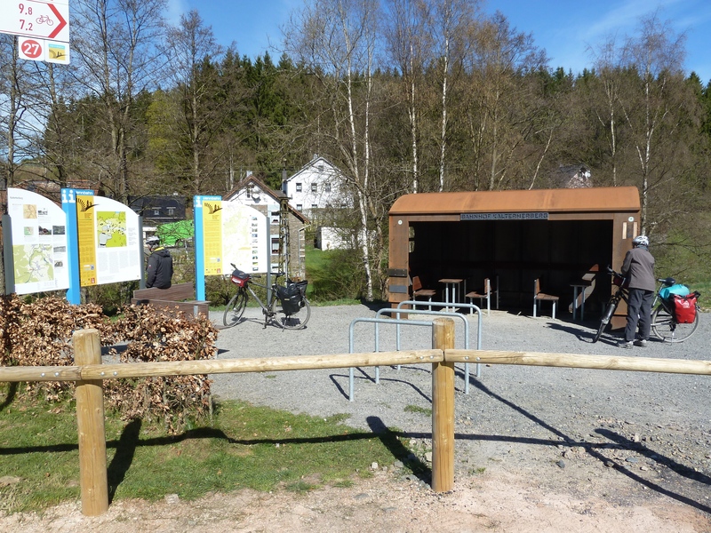
Reichenstein, Kalterherberg, Sourbrodt, Weywertz, Faymonville, Waimes, Born, Wallerode.
Guides/maps:
- RAVeL map of the Province of Liège published by the SPW. This map, called ‘More RAVeL, more pleasure’ can be ordered free of charge by clicking here.
- All the documentation can be obtained via the ATEB website (http://www.eastbelgium.com). In particular, a map to a scale of 1/100,000 is available which gives details of the path followed by the Vennbahn and indicates the connections with other RAVeL routes as well as other connections to the German cycling route and greenways network (Radweg).
Around the route by bike:
- VeloTour – Hautes Fagnes–Eifel nodal-points cycling route network: https://www.ostbelgien.eu/fr
- A number of loops use part of the route. These loops are included in a box set called ‘Vennbahn Plus’ which contains an illustrated map of the Vennbahn and a leaflet for each loop with a detailed map and tourist information. https://www.ostbelgien.eu/fr
Stage map