Find my route
Le Tour du Lac de l'Eau d'Heure(stage 1)
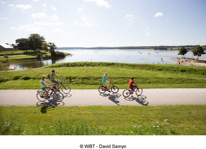
The tour around Eau d’Heure lake

Family
")
18,5 km
This 18.5-km tour leads you alongside the most winding, twisting of the five lakes. As you go along, you will see people jet-skiing and water-skiing, you can rest on a beach, bathe or have a picnic (in an authorised area, of course!).
Details
The route:
You start your ride on the car park near the reception centre along the main road (N589). You take the RAVeL.
Take care. Sometimes (one-third of the route), you will be sharing the road with cars. This will be the case after 2.6 km, when you will go along the N907 at the Féronval dam. After 500 metres, you turn right and take the RAVeL as far as Ry Jaune lake.
You cross the N978 and carry on to the water-skiing club. Here you continue to Falemprise and the beauty spot. Go along rue de Falemprise to join the N978 and back on to the RAVeL running parallel to this main road.
Lower down, you leave the RAVeL and continue on the N978. After the bridge, you take the first right to the Plate-Taille dam and your starting point.
Surface:
Asphalt (83%) - crushed brick (17%).
Height difference:
Hilly, ascent of 274 metres.
Signs:
Partial. The signs are to be completed shortly.
Warnings
Useful info
Start and finish:
Main road (N589) near the Eau d'Heure lakes reception centre (Plate-Taille dam).
Coordinates Lambert 72 : X : 150992 m - Y : 97928 m
GPS coordinates: Latitude: 50°11'32.91'' N - Longitude: 4°22'57.46'' E
Numerous car parks all along the route.
Rest areas:
There are several rest areas all along the route.
Guides/maps:
- RAVeL map of the Province of Hainaut published by the SPW. This map, called ‘More RAVeL, more pleasure’, can be ordered free of charge by clicking here.
Around the route by bike:
- Hainaut by bike – Hainaut Rando routes https://www.visithainaut.be
Stage map