Find my route
De Seneffe à Nivelles (stage 1)
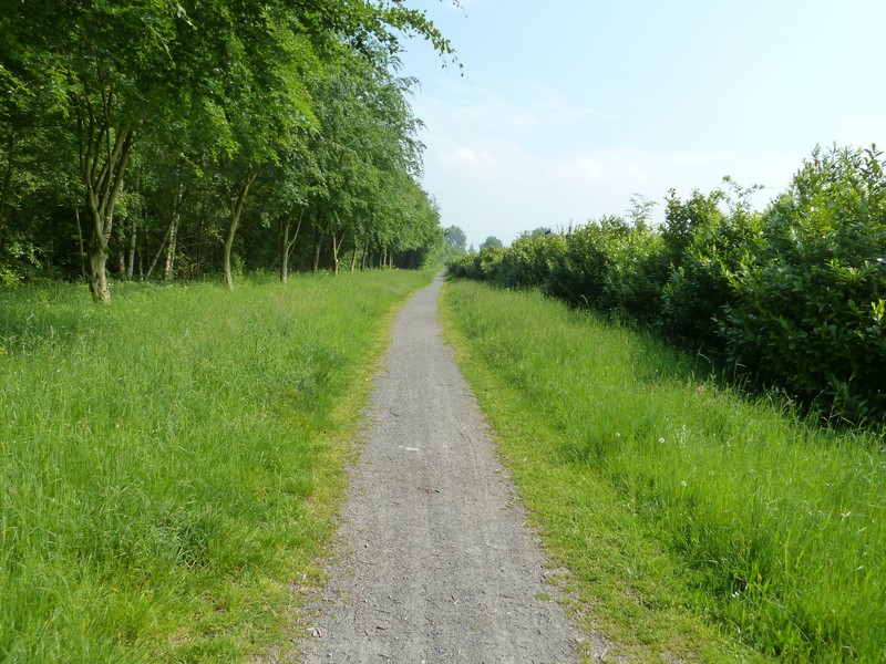
On the Line 141 pre-RAVeL and RAVeL

Family
")
10 km
The stage starts in the centre of Seneffe, not far from the superb Neoclassical château, which has become the Gold- and Silverware Museum of the Wallonia-Brussels Federation and a temporary exhibition site. Its park and gardens offer magnificent green settings pervaded by different atmospheres.
The Line 141 pre-RAVeL then takes you through woods as far as Arquennes on the site of the old railway station where you can still admire the buildings, which now house the post office, among other things.
You cross this picturesque village via a connecting route. As you go through, you will pass by a superb swing bridge designed by Eiffel that spans the old Charleroi-Brussels canal. From this bridge, on your left you will see the abutments of the old bridge on Line 141 over the canal. Leaving Arquennes, you take the newly asphalted RAVeL towards Nivelles.
Your path crosses the pretty Arpes wood and you leave the province of Hainaut and enter that of Walloon Brabant. You can admire the countryside through a few gaps in the trees along the way. You arrive in Nivelles on the site of the old Nord railway station, which marks the end of this first stage. Be sure to go to the Grand-Place to admire the superb Collegiate Church of St Gertrude.
Details
The route:
The stage follows its own safe path, except along the connecting routes through Arquennes and Nivelles.
Surface:
Uneven (fine stones) between Seneffe and Arquennes. Smooth (asphalt) between Arquennes and Nivelles.
Height difference:
Imperceptible incline.
Signs:
Full directional signs are in place along the entire route.
Safety, precautions:
Take care on the connecting routes as you pass through Arquennes and Nivelles and when crossing busy roads, especially:
- The N27 upon leaving Seneffe;
- The N28 upon entering Nivelles.
Connections:
- RAVeL of the old Charleroi-Brussels canal in Seneffe and Arquennes.
Warnings
Useful info
Starting point:
Seneffe, rue Rouge-Croix/Place de la Peine d'Agenais, near a large car park.
Coordinates Lambert 72 : X : 142273 m - Y : 135692 m
GPS coordinates: Latitude: 50°31'54.98'' N - Longitude: 4°15'35.12'' E
Arrival point :
Nivelles, car park on the site of the former Gare du Nord station, along the Avenue Albert et Elisabeth.
Coordinates Lambert 72 : X :147043 m - Y : 143495 m
GPS coordinates: Latitude: 50°36'07.67'' N - Longitude: 4°19'37.12'' E
Go to the centre of the town upon arriving: When you get to the car park on the site of the old Nord railway station, head towards Nivelles on the right. Turn left along Faubourg Sainte-Anne, which continues along rue Sainte-Anne. Carry straight on to the Grand-Place.
Return or continue by train: When you reach the Grand-Place, head towards the chancel of the Collegiate Church and turn left into rue de Namur which takes you to the railway station.
Guides/maps:
- RAVeL map of the Province of Hainaut published by the SPW. These maps, called ‘More RAVeL, more pleasure’, can be ordered by clicking here.
- ‘Roman Païs-Circuits vélo’ cycling routes map, available at the Roman Païs Tourist Office: http://www.tourisme-roman-pais.be.
Around the route by bike:
• Ride information sheet produced by the non-profit association Chemins du Rail: http://www.chemindurail.be/activites/fiches-balades/29/n-a
Stage map