Find my route
De Herve à Chênée (Liège) (stage 2)
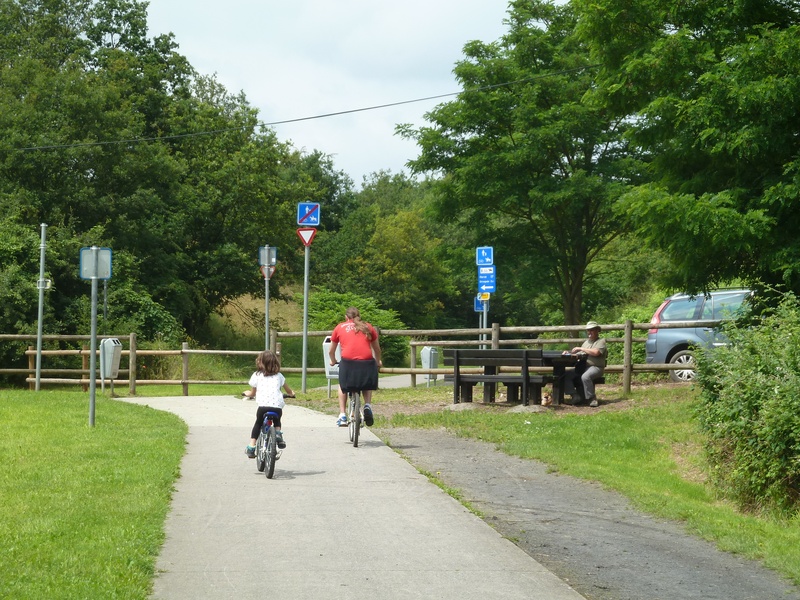
On the Line 38 RAVeL

Family
")
19.5 km
During this stage, the Line 38 RAVeL gradually leaves the bocages of the Pays de Herve region. From the ‘Hasard’ slag heap between Retinne and Micheroux, Line 38 forms a real ecological corridor and a green lung for local people as the Liège agglomeration becomes increasingly densely populated. People on this route for leisure and tourism purposes now rub shoulders with daily users going to work, school, or to do their shopping.
This section of Line 38 is characterised in particular by the conversion of several old railway stations that bear witness to the railway heritage to serve new purposes: brasserie/restaurant, function room, baker’s/tearoom or municipal administrative centre. A fine view over the imposing Notre-Dame de Chèvremont basilica marks the end of Line 38 before you reach Chênée railway station.
If you wish, after a short stretch in road traffic, the RAVeL in the valleys of the Ourthe and the Meuse rivers will take you to Liège in peace and quiet.
Details
The route:
From the Pays de Herve Tourist Office, you follow the Line 38 RAVeL along its own path. You pass through Melen and then Soumagne/Micheroux, Retinne, Fléron, Beyne-Heusay, Bois de Breux, Grivegnée and Vaux-sous-Chèvremont before reaching the end of the Line 38 RAVeL at Chênée railway station.
Surface:
Smooth, asphalt or concrete.
Height difference:
Imperceptible incline or flat, slight, steady downhill slope to Liège.
Signs:
Directional signs usually found on the RAVeL.
Safety, precautions:
Take care when crossing roads.
Connections:
• Section of the RAVeL that is part of the EV3 international route and the W2 regional route.
• At Vaux-Sous-Chèvremont, connection possible with the W6 regional route.
• At Chênée, connection possible with the W7 regional route and the Ourthe RAVeL.
Warnings
Useful info
Start:
Pays de Herve Tourist Office, rue de la Gare 1, 4650 Herve.
Coordinates Lambert 72 : X : 250550 m - Y : 148920 m
GPS coordinates: Latitude: 50°38'32.06 "N - Longitude: 5°47'25.43 "E
Parking: large car park nearby.
Arrival:
Chênée railway station, rue de la Station, 4032 Liège (Chênée).
Coordinates Lambert 72 : X : 238387 m - Y : 144897 m
GPS coordinates: Latitude: 50°36'28.97 "N -Longitude: 5°37'03.02 "E
Parking: station car park.
Go to the centre of Liège upon arriving:
Cross the cycle/footbridge across the N30 main road and the Ourthe river. Once you reach the left bank, simply follow the Ourthe RAVeL towards Liège as far as the Fétinne bridge (intersection with the La Meuse by bike cycling route). Cross the bridge and turn left immediately to join the RAVeL on the right bank of the Ourthe. You will come out at the confluence between the Ourthe and Meuse rivers. Follow the Meuse RAVeL for about two kilometres to the cycle/footbridge that takes you to the historic centre of the city of Liège.
Return or continue by train: Chênée or Liège-Guillemins railway stations.
Guides/maps:
- RAVeL map of the Province of Liège published by the SPW. This map, called ‘More RAVeL, more pleasure’, can be ordered free of charge by clicking here.
- Line 38 RAVeL leaflet published by the Pays de Herve Tourist Office.
Stage map