Find my route
Des Trois Frontières (Plombières) à Herve(stage 1)
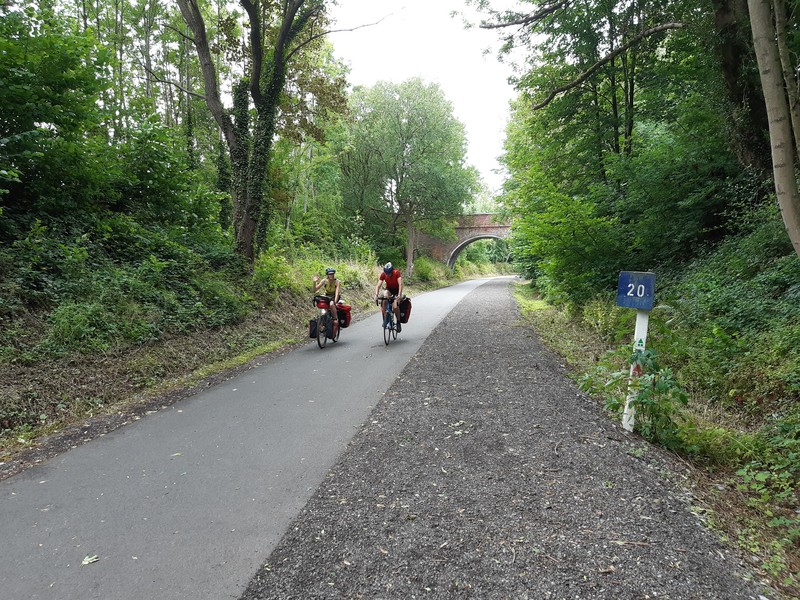
On the Lines 39 and 38 RAVeL

Family
")
30,5 km
Starting from the ‘Trois Frontières’ or ‘Three Borders’ panoramic tower, a symbolic spot set on the edge of the village of Gemmenich in Belgium and the towns of Vaals in the Netherlands and Aix-la-Chapelle/Aachen in Germany, you will cross the Pays de Herve region from east to west along Lines 39 and 38 RAVeL. The old railway line 38, one of the first of its kind, is a symbol of the RAVeL and its friendliness. It took years of effort by local people before the public authorities finally began to set up the line.
All along Lines 39 and 38, meadows and orchards reveal local products. Herve cheese, Liège syrup, Liège-style meatballs, cider and abbey beers as well as the products of local breweries can be savoured in old farmhouses converted into guest rooms, gourmet restaurants or the old Herve railway station, which now houses the Tourist Office with a brasserie area, where local products are on sale. Don’t hesitate to stop off at the Grain d’Orge brewery in Hombourg, Val-Dieu Abbey near Aubel or Clermont-sur-Berwinne, one of the most beautiful villages of Wallonia. Finally, it is worth mentioning that, in 1940, the German troops entered Belgium through this region. The marks of this invasion are still clear to see in the Laschet tunnel in Hombourg, the Henri-Chapelle American cemetery and the Fort of Battice.
Details
The route:
In the place called Trois Frontières, you head towards the Route des Trois Bornes in the direction of Gemmenich during 1,4 km. After, the Line 39 and 38 RAVeL leads you safely to Herve along its own path through the villages of Gemmenich, Plombières, Hombourg, Aubel, Froidthier, Thimister and Battice.
Surface:
Asphalt.
Height difference:
Between Trois Frontières and the start of the Line 39 RAVeL, one short stretch have inclines of 5 %. On the RAVeL, imperceptible incline but slight, virtually steady climb as far as Herve.
Signs:
Directional signs usually found on the RAVeL.
Safety, precautions:
Beware of motor traffic between Trois Frontières and the start of the Line 39 RAVeL. On the Lines 39 and 38 RAVeL, take care when crossing roads.
Connections:
Section of the RAVeL that is part of the EV3 international route and the W2 regional route.
Warnings
Useful info
Start:
Tour Panoramique des Trois Frontières, Route des Trois Bornes 99, 4851 Gemmenich (Plombières).
Coordinates Lambert 72 : X : 266600 m - Y : 161635 m
GPS coordinates: Latitude: 50°45'12.72 "N - Longitude: 6°1'16.53 "E
Access by train: Aix-la-Chapelle/Aachen Hauptbahnhof (main railway station) (D) is just over six kilometres from the start of the route in Trois Frontières.
Parking: large car park in Trois Frontières.
Rest areas:
Trois Frontières, Plombières, Herve
Guides/maps:
- VeloTour – Hautes Fagnes–Eifel nodal points cycling network.
- Nodal-points cycling route networks of the Provinces of Liège and Limburg.
Around the route by bike:
- Between Aubel and Herve, the Apple Tree ride, cycling loop of approximately 32 km.
Variant:
Alternatively, you can start the stage in the city of Aix-la-Chapelle/Aachen (D), which is about six kilometres from the start of the route in Trois Frontières.
Stage map