Find my route
De Montjoie/Monschau (D) à Sankt-Vith/Saint-Vith (stage 2)
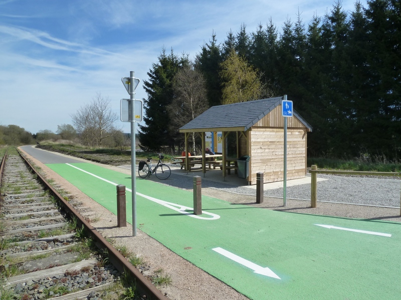
Line 48 RAVeL

Family
")
44 km
Starting from the old Montjoie/Monschau railway station, the way leads you towards the Rur valley in Belgium. A unique area of heath heralds the Hautes Fagnes nature reserve. This fascinating region of raised peat bogs is a huge water reservoir that forces visitors to cross many streams and rivers. Between Kalterherberg (D) and Sourbrodt (B), you will be accompanied by budding railway workers sitting tight on railbikes.
The Line 48 RAVeL – Vennbahn then goes slightly downhill to the south and crosses an open rural landscape. After Waimes, your route follows the wood known as Wolfsbusch. At Montenau, your nostrils will be assailed by a delicious smell of smoked fresh Ardennes ham, inviting you to linger here. Running partly alongside the Amblève river, the end of your stage leads you down a gentle slope to Saint-Vith/Sankt-Vith, a small but very lively town. At the museum of local life of Saint-Vith, visitors can find out about the eventful past of the Vennbahn.
Details
The route:
From the start at the site of the old Montjoie/Monschau railway station (D), the entire stage follows the Line 48 RAVeL – Vennbahn, apart from a short connecting stretch at the entrance St.Vith to reach the end of the stage.
Surface:
Smooth (asphalt).
Height difference:
Ascent of 257 metres. Imperceptible incline. On the RAVeL, the uphill and downhill slopes do not exceed a gradient of 1.5%. Slightly steeper slopes on the detour at the approach to Sourbrodt.
Signs:
The entire route is marked by special directional signs (‘Line 48 RAVeL - Vennbahn’).
Safety, precautions:
Take care when crossing the road in Kalterherberg, Sourbrodt and Weywertz.
Connection (the kilometres are counted from the starting point):
- In Kalterherberg (D): connection with the Rurufer Radweg (cycling route of the Rour in French/Rur in German/Roer in Dutch, known as the Rur in English) enabling you to follow this river from the Signal de Botrange to its estuary in the Meuse in Roermond (NL).
- In Weywertz, you can fork left on the Line 45A RAVeL towards Bütgenbach, Büllingen/Bullange (Line 45a RAVeL) and Jünkerath (D). Connection with the Kyll-Radweg.
- At the site of the old Waimes railway station, you can turn onto the Line 45 RAVeL towards Malmedy, Stavelot and Trois-Ponts.
Warnings
Stage map