Find my route
De Assenois (Vaux-sur-Sûre) à Martelange
On the Line 618 RAVeL

Family
")
21 km
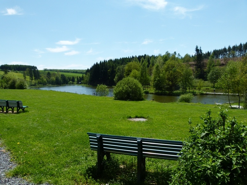
This route follows the old local railway line 618, now set out as a pre-RAVeL path between Assenois, the Strange lakes in Hompré and Martelange. You cross through many villages in the Pays de Bastogne region, in the peaceful, idyllic setting of the Strange and the Sûre valleys. Set largely in a Natura 2000 protected area, the surrounding countryside literally invites you to dawdle. Once you reach Martelange, you may decide to continue on towards Redange and Luxembourg city on the cycling routes network of the Grand Duchy.
In the commune of Fauvillers, metal ‘Tram Remembrance’ panels in the shape of the front of a locomotive bear the name of the old tram stops as well as local and historical information.
Details
The route:
The RAVeL of the old local railway line 618 goes through Assenois, Salvacourt, Hompré, the magnificent site of the Strange lakes (where you will be tempted to idle), Hollange, Strainchamps, Bodange, Wisembach and Radelange before arriving at the border town of Martelange.
Surface:
Smooth (asphalt).
Height difference:
Flat or imperceptible incline.
Signs:
The entire route is marked by specific ‘Line 618’ directional signs.
Safety, precautions:
Take care when crossing roads.
Connections:
- At the end of the route to Martelange, you can turn onto the EuroVelo 5 by joining the national cycling routes network of the Grand Duchy of Luxembourg in order to reach Redange, Arlon or Luxembourg city.
Warnings
Useful info
Start:
Site of the old Assenois local railway station.
Coordinates Lambert 72: X : 244200 m - Y : 736685 m.
GPS coordinates: Latitude: 55° 54’ 56.43’’ N - Longitude : 05° 52’ 7.08’’ E.
Finish:
Martelange, sports hall car park, rue de Radelange, along the N848.
Coordinates Lambert 72 : X : 247925 m - Y : 58696 m
GPS coordinates: Latitude :49°49'54'' N - Longitude : 5°43'48'' E
Rest areas:
Strange lakes in Hompré (for patrons only), Tannerie park in Martelange (upon arrival, behind the sports centre).
Guides/maps:
- RAVeL map of the Province of Luxembourg published by the SPW. This map, called ‘More RAVeL, more pleasure’, can be ordered free of charge by clicking here.
- For the PC (Luxembourg national cycle paths), see the map ‘Luxembourg By Cycle’ from the association LVI, the Luxembourg cycling initiative: www.lvi.lu.
Stage map