Find my route
De Liers (Herstal) à Saint-Nicolas (Terril du Gosson)
On the RAVeL of Lines 31, 210 and 212

Family
")
10,5 km
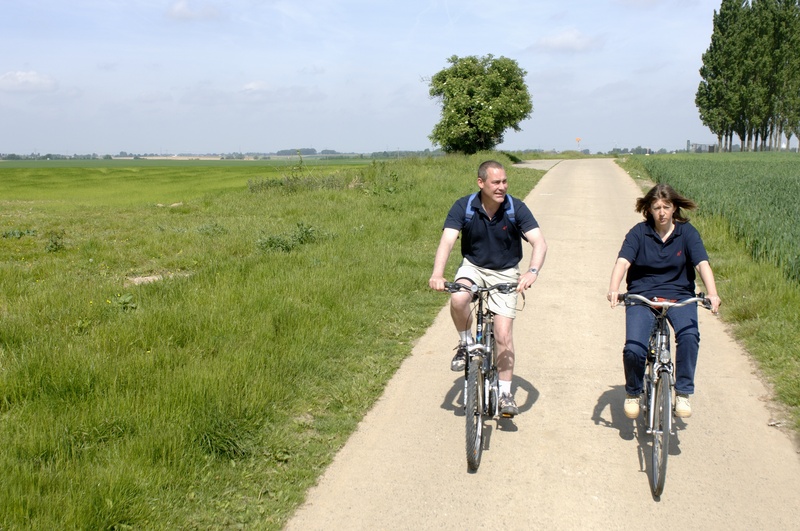
We invite you here to an urban RAVeL. This in fact consists of several lines combined, which cover a total of about ten kilometres…
Urban? You said urban? That’s right, you go to the gates of Liège crossing through Liers, Rocourt, Ans and Montegnée, marked by densely populated areas and in some communes, a significant industrial presence. But here the surroundings are green and airy, away from the noise of the city. The path is used for everyday travel to schools, leisure centres and shops or to reach an island in the countryside and then Liège via the Meuse valley.
This is one of the most interesting sites in the region in terms of both its plant life and the animals found here. A visit to the Maison des Terrils or slag heaps centre (slag heap No 1), rue Chantraine, is a good way to approach the site.
Details
The route:
The route runs almost entirely along the RAVeL of Lines 31, 210 and 212.
Surface:
Smooth (alternately concrete and asphalt).
Height difference:
Imperceptible incline, ascent of 79 metres.
Signs:
Full directional signs usually found on the RAVeL.
Connections:
- At the starting point in Liers, a signposted connecting route takes you to Fexhe-Slins, Houtain-Saint-Siméon and the Meuse RAVeL in Haccourt on the one hand and to the Geer valley nodal-points cycling network on the other.
- About 300 metres after the start, a signposted connecting route takes you to Vottem and Herstal along the routes The Meuse by bike and W6.
- Between Ans and Burenville, route shared with the W2 regional route.
- At the finish, a signposted connecting route takes you to Jemeppe and Seraing along the routes The Meuse by bike, EV3 and W6.
Warnings
Useful info
Starting point:
Chaussée de Brunehaut at 1 km (Former railway crossing), Liers.
Coordinates Lambert 72 : X = 234096 m - Y = 154711 m
GPS coordinates: Latitude = 50°41'48.83'' N - Longitude = 5°33'32.82'' E
Access by train: From Liers Belgian railway station, take the provincial road and then rue Léopold Thonon. When you reach the chaussée Brunehaut, turn right. The RAVeL is 40 metres further along on your left.
Arrival point:
Rue de la Xhavée, Jemeppe-sur-Meuse.
Coordinates Lambert 72 : X = 230704 - Y : 146585 m
GPS coordinates: Latitude = 50°37'27.60'' N - Longitude = 5°30'33.63'' E
Guides/maps:
- RAVeL map of the Province of Liège published by the SPW. This map, called ‘More RAVeL, more pleasure’, can be ordered free of charge by clicking here.
Around the route by bike:
- To Maastricht and to Visé, connection to the nodal-points cycling networks of the Lower Meuse, Belgian Limburg and Dutch Limburg.
Stage map