Find my route
De Cuesmes (Mons) à Quiévrain (stage 1)
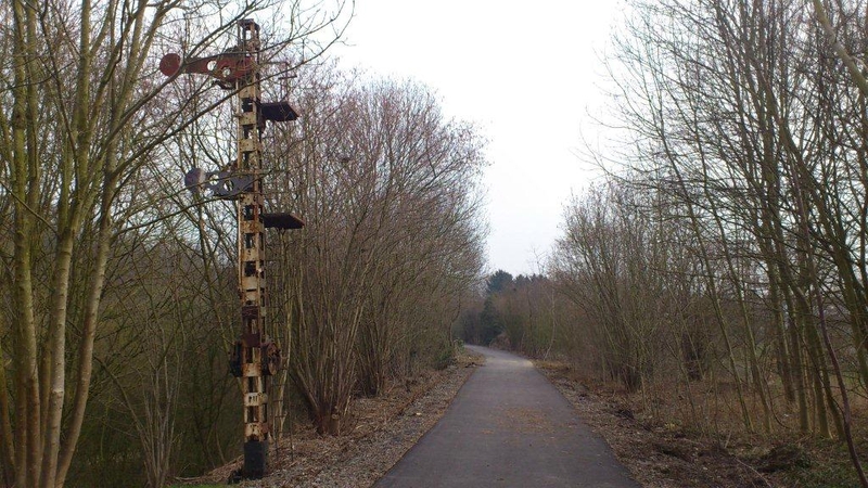
On the Line 98 RAVeL

Family
")
21 km
The Line 98 RAVeL crosses the Borinage from east to west, enabling non-motorised users coming from Mons to go as far as the French border along its own path.
Widely used for daily trips in urban areas, it is certainly one of the most interesting from the point of view of railway heritage. The user's journey is dotted with witnesses to the past, bollards, waymarks, railway bridges and road bridges. Reminders of the railway and industry, but also green slag heaps and pastoral valleys that delight the eye of the naturalist and more.
Details
The route:
You start off on the Line 98 RAVeL in Cuesmes (Mons), rue de Ciply, along the railway track. You head towards Flénu across the new Clara footbridge.
After going under the motorway and passing by the Saint-Joseph slag heap, the Line 98 RAVeL is briefly joined by the Line 98C RAVeL. After Flénu railway station, you fork left towards Paturâges, whose name harks back to its farming origins. As you cross through places like Colfontaine, Wasmes, Boussu-Bois, Bois Saint-Antoine and Dour, your path alternates between a dense urban fabric, slag heaps literally drawn out of the ground by industry and surprising countryside.
You may be tempted to follow lines 98B and 98C, but that will be for later…
After Dour, you carry on towards Elouges and end your journey in Quiévrain, a border town well known to our French friends from the traditional expression: “Outre-Quiévrain” (Beyond Quiévrain) used by Belgians to refer to the French and vice versa.
Surface:
Smooth, alternately concrete and asphalt.
Height difference:
Flat.
Signs:
Full directional signs are in place along the entire route.
Connections:
- Line 98C RAVeL in Flénu.
- Line 98B RAVeL in Boussu-Bois.
- Line 98A RAVeL in Elouges, part of the W1 regional route.
- Between Elouges and the entrance to Quiévrain, path shared with the W1 regional route.
Warnings
Useful info
Start:
Rue de Ciply, Cuesmes.
Coordinates Lambert 72 : X : 119126 m - Y : 124334 m
GPS coordinates: Latitude: 50°25'44.65" N - Longitude: 3°56'03.15'' E
Finish:
Place de la Gare, Quiévrain.
Coordinates Lambert 72 : X : 101555 m - Y : 122378 m
GPS coordinates: Latitude: 50°24'37.07'' N - Longitude: 3°41'13.81'' E
Guides/maps:
- RAVeL map of the Province of Hainaut published by the SPW. This map, called ‘More RAVeL, more pleasure’, can be ordered free of charge by clicking here.
Around the route by bike:
- Hainaut by bike – Hainaut Rando routes.
Stage map