Find my route
Boucle du Barrage d'Eupen
Between the dam and Osthertogenwald

Medium
")
14,5 km
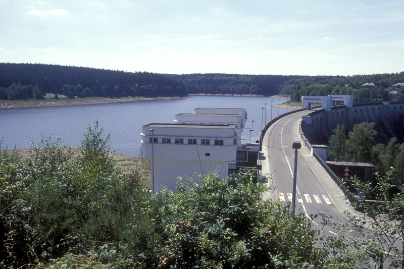
Your walk is a loop in the heart of the superb Hertongenwald, on the slopes of the East Cantons of Wallonia. The path leads around the artificial lake created following the construction of a dam 63 metres high across the river Vesdre in the 1940s. The grandiose landscapes and outstanding view over the lake on one side and the narrow Langesthal valley on the other side will delight you.
After exertion, comfort. You can recover in the ‘Wesertalsperrer’ visitors’ centre where you can take a final look at the superb panoramic view of the lake and its surroundings from the terrace.
Details
The route:
The route follows its own path on the RAVeL apart from crossing the dam, when you go along the road.
Surface:
Alternately smooth and uneven.
Height difference:
Hilly, ascent of 189 metres.
Signs:
No signs.
Safety, precautions:
You are on a route that follows its own path. Take care when crossing the dam.
Connections:
- In Eupen (six kilometres), you can join the Eupen-Centre connecting cycle path - Line 48 RAVeL (Vennbahn).
Warnings
Useful info
Start and finish:
Start from the beginning of the RAVeL, right next to the dam and the car park.
Coordinates Lambert 72 : X : 271882 m - Y : 146888 m
GPS coordinates: Latitude: 50°37'11.69" N - Longitude: 6° 5'28.48"
Access by train: Eupen Belgian railway station six kilometres away
Rest areas:
There are several rest areas along the way.
Guides/maps:
- RAVeL map of the Province of Hainaut published by the SPW. This map, called ‘More RAVeL, more pleasure’, can be ordered free of charge by clicking here.
- All documentation can be obtained via the ATEB website(https://www.ostbelgien.eu/fr).
Around the route by bike:
- VeloTour – Réseau cyclable à points-nœuds Hautes Fagnes – Eifel: https://www.ostbelgien.eu/fr
Stage map