Find my route
De Herve à Aix-la-Chapelle/Aachen (D) (stage 6)
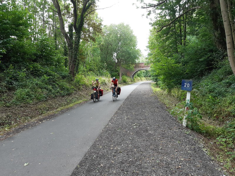
On the Lines 38 and 39 RAVeL

Family
")
31 km
The old No 38 railway line, one of the first of its kind, is a symbol of the RAVeL and its friendliness. It took years of effort by local people before the public authorities finally began to set up the line. This work is continuing today and will do so in the years to come.
All along Lines 38 et 39 RAVeL, meadows and orchards reveal local products. You can enjoy Herve cheese, Liège syrup, Liège-style meatballs, cider and abbey beers both at the start of your stage in the old Herve railway station and in old farmhouses converted into guest rooms or gourmet restaurants.
Don’t hesitate to leave this green corridor to visit the wealth of heritage in this beautiful, gentle region. After the village of Thimister, in a few minutes you reach Clermont-sur-Berwinne, one of the most beautiful villages of Wallonia. Val-Dieu abbey is not far from Aubel. You will also pass by the Plombières mining site.
It is worth mentioning that in May 1940, the German troops entered Belgium through this region. The marks of this invasion are still clear to see in the Fort of Battice, the Henri-Chapelle American cemetery and the old Laschet tunnel in Hombourg.
Finally, your journey comes to an end at the top of the Trois Frontières or Three Borders panoramic tower, a symbolic spot set on the edge of the village of Gemmenich in Belgium and the towns of Vaals in the Netherlands and Aix-la-Chapelle/Aachen in Germany.
Details
The route:
The Lines 38 and 39 RAVeL takes you safely on its own path through the villages of Battice, Thimister, Froidthier, Aubel, Hombourg, Plombières and Gemmenich. You pass through Gemmenich before going up the Route des Trois Bornes (1,4 km) towards the place called Trois Frontières.
Surface:
Asphalt.
Height difference:
On the RAVeL, imperceptible incline. Between the end of the RAVeL in Gemmenich and Trois Frontières, one short stretch with gradients of 5 %.
Signs:
Specific W2 directional signs are in place along the entire route.
Safety, precautions:
On the Lines 38 and 39 RAVeL, take care when crossing roads. Watch out for motor traffic between the end of the Line 39 RAVeL in Gemmenich and Trois Frontières.
Connections:
Stage shared with the EV3 international route.
Warnings
Useful info
Start:
Pays de Herve Tourist Office, rue de la Gare 1, 4650 Herve.
Coordinates Lambert 72 : X : 250550 m - Y : 148920 m
GPS coordinates: Latitude: 50°38'32.06" N - Longitude: 5°47'25.43" E
Parking: Large car park near the Pays de Herve Tourist Office.
At the finish:
The centre of Aix-la-Chapelle/Aachen (D) is approximately six kilometres from Trois Frontières. There are two railway stations here, with trains to all destinations.
Rest areas:
Herve, Plombières, Trois Frontières.
Guides/maps:
- RAVeL map of the Province of Liège published by the SPW. This map, called ‘More RAVeL, more pleasure’, can be ordered free of charge by clicking here.
- Line 38 RAVeL leaflet published by the Pays de Herve Tourist Office: www.paysdeherve.be/fr/ligne-38-ravel
Around the route by bike:
- Between Herve and Aubel, the Apple Tree ride, a loop of approximately 32 km: www.paysdeherve.be/fr/velo#cdf_id_circuit=28140.
- VeloTour – Hautes Fagnes–Eifel nodal-points cycling route network: www.eastbelgium.com/fr/loisirs/velo/velotours/home/reseau-de-pistes-cyclables/.
- Nodal-points cycling route networks of Provinces of Liège and Limburg.
Stage map