Find my route
De Liège à Herve (stage 5)
On the RAVeL of the Ourthe and Line 38

Family

24 km
Your stage starts on the RAVeL on the right bank of the Meuse in Parc de la Boverie with its future International Centre of Art and Culture. Having followed the Ourthe valley for a few kilometres to Chênée, a short stretch in road traffic takes you to the Line 38 RAVeL, with a beautiful view of the imposing Notre-Dame de Chèvremont basilica.
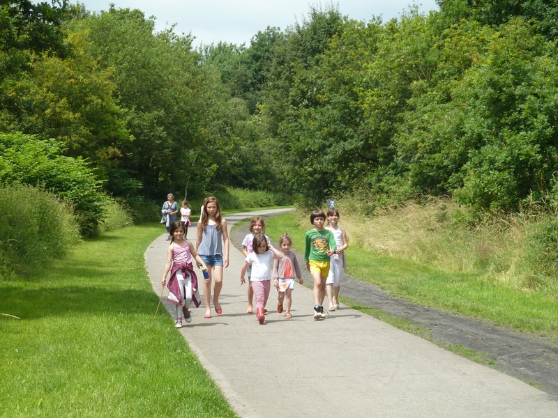
Here, Line 38 forms a real ecological corridor and a green lung for local people from the Liège area. Users who take this route on a daily basis to go to work, school or do their shopping rub shoulders with people here for leisure and tourism purposes. From the ‘Hasard’ slag heap between Retinne and Micheroux, Line 38 gradually leaves behind its urban setting, crossing the bocages of the Pays de Herve region from west to east.
This section of Line 38 is characterised in particular by the conversion of several old railway stations that bear witness to the railway heritage to serve new purposes: municipal administrative centre, baker’s/tearoom, function room, brasserie/restaurant and the Pays de Herve Tourist Office, the end of your stage, where you can buy, taste and sip the best products the region has to offer. These include the famous Herve cheese with its characteristic smell that leaves no-one indifferent. This is the only cheese in Wallonia that holds the Protected Designation of Origin label.
Details
The route:
Your trip starts on the RAVeL on the right bank of the Meuse in the Parc de la Boverie. Behind you is the footbridge spanning the Meuse towards Liège-Guillemins railway station. You follow the course of the Meuse to its confluence with the Ourthe. You cross the Ourthe via Fétinne bridge.
After the bridge, turn left immediately and follow the Ourthe RAVeL (left bank) along the Quai du Condroz. You go past the Belle-Île shopping centre and continue on the RAVeL which runs along its own path to Chênée and a (red) cycle-footbridge which enables you to cross the Ourthe RAVeL and join the Line 38 RAVeL. You then simply follow the RAVeL along its own safe path, going slightly uphill. You go successively through Vaux-sous-Chèvremont, Grivegnée, Bois-de-Breux, Beyne-Heusay, Fléron, Retinne, Micheroux/Soumagne and Melen. You end your journey in Herve.
Surface:
Smooth, asphalt or concrete.
Height difference:
Imperceptible incline or flat, slight, steady uphill slope to Fléron.
Signs:
Directional signs are in place along the entire route.
Connections:
- Stage shared with The Meuse by bike international route and the W7 regional route between the Parc de la Boverie in Liège and the Quai du Condroz in Angleur. At the Quai du Condroz in Angleur, you can turn onto the routes ‘The Meuse by bike’, EV3 and W6 towards Huy.
- From the Quai du Condroz to the footbridge over the Ourthe in Chênée, stage shared with routes EV3, W6 and W7. At the footbridge over the Ourthe in Chênée, you can turn onto the W7 route following the Ourthe RAVeL towards Esneux and Durbuy.
- In Vaux-sous-Chèvremont, you can turn onto the W6 regional route towards Chaudfontaine. If you continue on the W2 route towards Herve and Aix-la-Chapelle/Aachen, you will join Line 38 and your stage is shared with that of the EV3 international route.
Warnings
Useful info
Start:
Parc de la Boverie in Liège, at the bottom of the footbridge spanning the Meuse towards Liège-Guillemins railway station.
Coordinates Lambert 72 : X : 235375 m - Y : 147135 m
GPS coordinates: Latitude: 50°37'43.00 "N - Longitude: 5°34'31.70 "E
Rest areas:
Parc de la Boverie, Herve.
Guides/maps:
- RAVeL map of the Province of Liège published by the SPW. This map, called ‘More RAVeL, more pleasure’ can be ordered free of charge by clicking here.
Stage map


