Find my route
De Thuin à Chimay (stage 3)
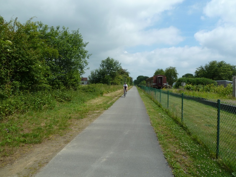
On the Line 109/2 RAVeL

Family
")
45 km
You leave Thuin and the Thudinie region along the Line 109/2 RAVeL, heading out of the restful Sambre valley and into the Botte du Hainaut through pastures, fields of crops and small valleys where silence reigns supreme. At the start of your route, Line 109/2 is shared between the RAVeL and the tourist tramway.
The RAVeL leads you peacefully through Thuillies, Ossogne and Strée, villages of brick-built thatched cottages typical of the region. You approach the French border through the bocages of the Hainaut fens and reach Beaumont, a medieval town whose Salamandre Tower still stands proud.
You then wander through the state-owned forest of Sivry-Rance, a red marble quarrying centre, and the Pays d’entre-lacs region. At Froidchapelle, you cross the Lakes cycling route, which links that of Eau d’Heure with that of Val Joly (F).
Having crossed what is certainly the greenest region of Hainaut, you finally reach the end of your expedition in the City of the Princes of Chimay, where you will have earned the right to sample, in moderation, a famous Trappist beer, carefully brewed by the monks of Scourmont Abbey.
Details
The route:
The route follows its own safe path along the Line 109/2 RAVeL.
Surface:
Smooth, asphalt.
Height difference:
Flat or imperceptible incline.
Signs:
The route is marked by directional signs indicating the destinations to follow. It should be noted, however, that the W3 identification panels have not yet been put up.
Connections:
- In Froidchapelle you can join the Lakes cycling route and follow the directional signs to the Eau d’Heure lakes in Belgium or to Val-Joly lake in France.
Warnings
Useful info
Start:
At the start of the Line 109/2 RAVeL, by the level crossing between avenue de la Couture and rue du Fosteau in Thuin, near the Centre de Découverte du Chemin de Fer Vicinal (tram centre).
Coordinates Lambert 72 : X : 143650 m - Y : 114580 m
GPS coordinates: Latitude: 50°20'31.75 "N - Longitude: 4°16'46.31 "E
Access by Train: Thuin SNCB railway station.
Parking: Many parking possibilities nearby.
Guides/maps:
- RAVeL map of the Province of Hainaut published by the SPW. This map, called ‘More RAVeL, more pleasure’, can be ordered free of charge by clicking here.
Around the route by bike:
- Hainaut by bike – Hainaut Rando routes: http://www.hainauttourisme.be/loisirs-et-activites/itineraires-thematiques/
- Nodal-points network in Hainaut: http://www.1000bornesavelo.be
Stage map