Find my route
De La Louvière à Thuin (stage 2)
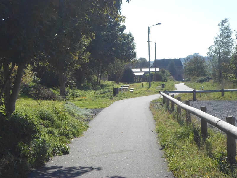
On the RAVeL of Lines 422, 108 and 109/1

Family
")
30,5 km
Before leaving La Louvière, a multicultural place, go and take a look at the hydraulic boat lifts on the Canal du Centre historique, which are included on the UNESCO Heritage of Humanity list.
Then resume your trip south on the Line 422 RAVeL through Saint-Vaast, Trivières and Péronnes before entering Binche, known all over the world for its Gilles, the famous carnival characters. The Binche carnival is recognised as a Masterpiece of the Oral and Intangible Heritage of Humanity by UNESCO.
You leave behind you the medieval ramparts of Binche and head in peace and quiet along the RAVeL of Lines 108 and 109/1 through fields and woods to the final destination of your stage. Thuin, which was and remains a centre of inland waterway transport, is a city abounding in works of architecture, well known for its hanging gardens, nestling in the hollow of the rural Sambre valley.
Details
The route:
The route runs mainly along its own path, following the Line 422 (pre-)RAVeL between Saint-Vaast (as you leave La Louvière) and Binche, then Line 108 between Binche and Fauroeulx and finally Line 109/1 between Fauroeulx, Lobbes and Thuin.
To reach the start of the Line 422 pre-RAVeL in Saint-Vaast, leave La Louvière along rue de Bouvy. You go over the railway line and the Line 422 pre-RAVeL is about 500 metres further along, on your right (2nd right). From here, you simply have to follow the signs to Thuin.
Surface:
Smooth (mostly asphalt).
Height difference:
Flat or imperceptible incline.
Signs:
Except for the first 600 metres, the route has directional signs indicating the destinations to follow. It should be noted, however, that the W3 identification panels have not yet been put up.
Safety, precautions:
You cross through La Louvière and Binche along urban roads where the motor traffic is generally slow but heavy, so you need to take great care.
Warnings
Useful info
Start:
At the crossroads between rue de Bouvy and rue Jean-Baptiste Ballas in La Louvière.
Coordinates Lambert 72: X: 136597 m - Y: 128474 m
GPS coordinates: Latitude: 50°28'1.00 "N - Longitude: 4°10'47.84 "E
Access by train: La Louvière-Sud Belgian railway station about 600 metres away.
Parking: Cars can be parked in rue de la Gare de Bouvy.
Guides/maps:
- RAVeL map of the Province of Hainaut published by the SPW. This map, called ‘More RAVeL, more pleasure’, can be ordered free of charge by clicking here.
Around the route by bike:
- Hainaut by bike – Hainaut Rando routes: http://www.hainauttourisme.be/loisirs-et-activites/itineraires-thematiques/
Stage map