Find my route
De Renaix/Ronse à Grammont/Geraardsbergen (stage 2)
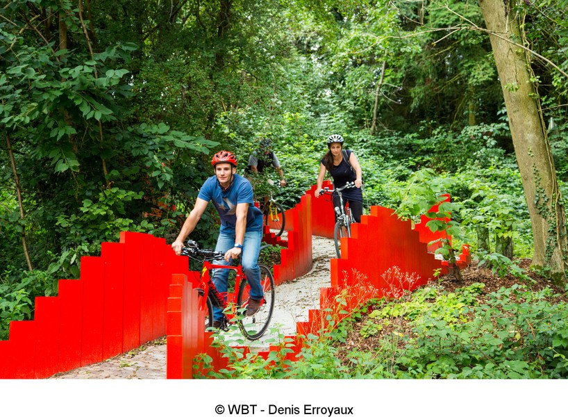
On the RAVeL of Line 87 and the Dendre

Family
")
28 km
Starting from Renaix/Ronse, a town set within one of the hilliest regions of Flanders, known for that matter as the Flemish Ardennes, you follow the RAVeL virtually from one end to the other along this stage.
You enter Wallonia on the old No 87 railway line, converted into a greenway, and penetrate deep into the Pays des Collines region.
If you are lucky, you may meet an owl known as the ‘white lady’ as you cross Ellezelles. You can imagine this, too, as you savour a Quintine beer in the Légendes brewery just a stone’s throw from your route.
Keep your eyes wide open. because you are riding through a nature reserve here. Buzzards, hawks, falcons and kestrels fly overhead in search of small rodents for their daily meal. You cross Flobecq, where you may be tempted to stop at the medicinal plants centre before continuing on your way towards Lessines.
Note that the Line 87 RAVeL between Flobecq and Lessines is currently being laid out and you have two options to reach Lessines:
- either you can take the N57 regional road, chaussée de Renaix (it has a cycle path, but the traffic is fast);
- or you can follow the local roads and paths of the Wallonie picarde (Western Hainaut) by bike nodal-points network.
- Lessines was founded by the Saxons in around the 5th century and the town is proud of its Flemish Renaissance style heritage. Be sure to visit the Notre-Dame à la Rose hospital, recognised as part of the exceptional heritage of Wallonia since 1940.
Rest assured, you will not have to climb the famous Wall in Gerrardsbergen/Grammont (a steep, cobblestone street) to reach this end of this stage. The Dendre RAVeL takes you safely and effortlessly to the historic centre of Grammont/Geraardsbergen, a major point along the route of the Tour of Flanders cycle race.
Details
The route:
The route runs largely along the RAVeL of Line 87 and the Dendre.
Surface:
Smooth - alternately asphalt and concrete.
Height difference:
Flat or imperceptible incline.
Signs:
Full directional signs with EV5 identification panels are in place in Wallonia.
Safety, precautions:
Most of the time, you will be on the RAVeL’s own path or on quiet roads. Caution is needed as you cross Flobecq and at the end of the Line 87 RAVeL in Lessines between the chaussée de Grammont and the Dendre river.
Connections:
Route shared with the W2 regional route as far as the Dendre RAVeL in Lessines. From this point, the route is shared with the W1 regional route. Heading north, you continue on your way towards Grammont/Geraardsbergen. If you turn onto the W1 route leading the south, this takes you towards Ath and Beloeil.
Warnings
Useful info
Start:
Start of the Line 87 greenway in Renaix/Ronse, rue Monseigneur Beylsstraat
Coordinates Lambert 72 : X : 97477 m - Y : 159598 m
GPS coordinates: Latitude: 50°44'40.37 "N - Longitude: 3°37'28.41 "E
Access by train: Renaix (Ronse) Belgian railway station, nodal point No 34 of the East Flanders network. Follow NP Nos 29, 92, 41 and 91 to join the Line 87 route.
Parking: A few parking spaces are available near the start.
Rest areas:
Several rest areas have been set up along the Line 87 RAVeL.
Guides/maps:
- RAVeL map of the Province of Hainaut published by the SPW. This map, called ‘More RAVeL, more pleasure’, can be ordered free of charge by clicking here.
- Maps of West and East Wallonie picarde (Western Hainaut) by bike: wapishop.be.
Around the route by bike:
- Wallonie picarde (Western Hainaut) by bike: www.wapinature.be/-A-velo-.html.
- Hainaut by bike – Hainaut Rando routes: https://www.visithainaut.be/.
Stage map