Find my route
De Namur à Huy (stage 3)
On the Meuse RAVeL

Family
")
31 km
The city of Namur, capital of Wallonia and the gateway to the Ardennes, is a multi-faceted place. From the Citadel, overlooking the confluence of the Sambre and Meuse rivers, to its historic centre, the art of good living is everywhere. You leave Namur following the RAVeL on the right bank of the Meuse and go past the remarkably restored site of the Moulins de Beez mill complex.
Further on stands Andenne, the city of the bear, where stone, water and wood remind us how much the wealth of this region depends on these natural elements.
As soon as you enter Huy with its rich historical heritage, passing beneath the headland on which the Citadel stands, you will have but one thought in mind: to find the famous ‘wall’, the steep climb that puts such a strain on the calves of racing cyclists!
Details
The route:
From the start in Namur, more specifically on the right bank of the Meuse beneath the Ardennes bridge in Jambes, until the end in Huy, the stage runs along its own RAVeL path.
Surface:
Mostly smooth. Alternately asphalt and concrete.
Height difference:
Flat.
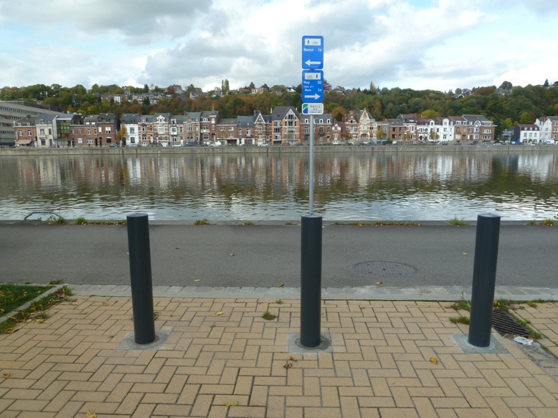
Signs:
Specific ‘The Meuse by bike’ directional signs are in place along the entire stage. This is very useful, especially for crossing Huy.
Warnings
Useful info
Start:
Quai de Meuse, at the foot of the Pont des Ardennes in Jambes (right bank of the Meuse).
Coordinates Lambert 72 : X : 185975 m - Y : 128088 m
GPS coordinates: Latitude: 50°27'45.06 "N - Longitude: 4°52'31.54 "E
Access by Train: Namur SNCB railway station or Jambes SNCB railway station.
Access by car : Parking possible near the starting point.
Guides/maps:
- RAVeL map of the Province of Namur published by the SPW. This map, called ‘More RAVeL, more pleasure’, can be ordered free of charge by clicking here.
Stage map