Find my route
De Huy à Liège (stage 4)
On the Meuse RAVeL and connecting cycle paths

Expert
")
39 km
As you leave the old fortified city of Huy, the cooling towers of the Tihange nuclear power plant stand before you. After a few kilometres along the RAVeL on the right bank of the Meuse, you will see on your left the towers of Amay collegiate church dating from the 7th century. Liège, the city of the prince-bishops, appears before you with the prestigious Val Saint Lambert site just as you enter.
It consists of the castle and its old Cistercian abbey built during the 13th century. You have the opportunity to visit the famous Val Saint Lambert glassworks which boasts a long and internationally renowned industrial past. Liège, known as the Cité Ardente reflecting its warm, welcoming and lively atmosphere, reveals its industrial, architectural and cultural heritage to you. Its museums, its folklore, the warmth of local people and its districts bustling with activity both day and night make this an unmissable stage along your route.
Details
The route:
You cross Huy along a well signposted connecting stretch on municipal roads. You reach the RAVeL running along its own path on the right bank of the Meuse at the foot of the chimneys of the Tihange nuclear power plant. You follow the RAVeL until the entrance of Seraing.
Having crossed Seraing along the new urban boulevard, you have to cross the bridge from the right bank to the left bank of the Meuse. As you come off the bridge, follow the signs on local roads towards Liège and the districts of Tilleur and Sclessin.
As you leave Sclessin, in the place called Val-Benoît, at the cable-stayed motorway bridge across the Meuse, take the footbridge alongside the railway line to reach the right bank of the Meuse.
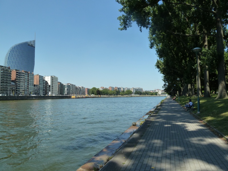
You enter Liège, at the confluence of the Ourthe and the Meuse, via the RAVeL on the right bank of the Meuse. When you go through the Parc de la Boverie, if you wish you can go across a cycle-footbridge over the Meuse to the monumental Liège-Guillemins railway station designed by the Spanish architect Santiago Calatrava. Note, however, that the Meuse cycling route continues through the Parc de la Boverie on the right bank of the Meuse. You then go past the Finance Tower on your left and the Palais des Congrès conference centre on your right. The stage ends at the bottom of the footbridge which connects directly with the city centre.
Surface:
Mostly smooth. Alternately asphalt and concrete.
Height difference:
Flat.
Signs:
Specific ‘The Meuse by bike’ directional signs are in place along the entire stage. This is very useful, especially when crossing Seraing and on the sections on local roads between Engis bridge and Ivoz-Ramet, and between Seraing and the entrance to Liège.
Safety, precautions:
Between Seraing and the entrance to Liège, the route mostly follows local roads where the traffic is light to moderate and not particularly fast, but which do not have any cycle paths (± 7 kilometres on shared roads).
Connections:
- Stage shared with the EuroVelo 3 and W6 regional routes. At the Quai du Condroz on the approach to Liège, in Angleur, along the Ourthe, the EV3 and W6 regional routes turn off and go along the Ourthe RAVeL in the direction of Herve and Aachen (D) in the case of the EV3 and Chaudfontaine in that of the W6.
- Again at Quai du Condroz, you can join the W7 regional route and the W2 regional route. If you go along the Ourthe RAVeL following the W7 and W2 routes, you head towards Esneux and Durbuy along the W7 and towards Herve and Aachen (D) along the W2.
- In the Parc de la Boverie in Liège, you can turn onto the W2 regional route. If you cross the cycle-footbridge over the Meuse, you head towards Waremme and Brussels.
- In Jemeppe-sur-Meuse, which lies opposite Seraing, you can join the RAVeL of Lines 212 and 210 towards Montegnée and Ans.
Warnings
Useful info
Start:
Baudouin bridge on the right bank in Huy.
Lambert 72 coordinates: X: 211676 m - Y: 134679 m
GPS coordinates: Latitude: 50°31'10.65"N - Longitude: 5°14'18.50"E
Access by train: Huy Belgian railway station.
Parking possible near the starting point.
Rest area:
Parc de la Boverie in Liège.
Guides/maps:
- RAVeL map of the Province of Liège published by the SPW. This map, called ‘More RAVeL, more pleasure’, can be ordered free of charge by clicking here.
Stage map