Find my route
De Saint-Vith/Sankt-Vith à Troisvierges (L) (stage 3)
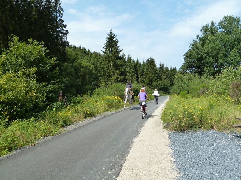
On the Line 47 RAVeL

Family
")
32 km
Starting in Saint-Vith, a commune that has been tossed from one side of the border to the other by the vagaries of history, this stage takes you towards the romantic Our valley, nestling among the massifs of the Eifel and the Ardennes. Heading towards Hemmeres, you again cross the Belgian-German border.
Returning to Belgium via the village of Auel, in the distance you will soon see the ruins of the Burg-Reuland fortress, the high point of this stage, which has overlooked the region since the 12th century.
You then go along the river Ulf towards the Grand Duchy of Luxembourg where, shortly after Lengeler, an undeveloped tunnel marks the border. The tunnel is unfortunately inaccessible as a rare species of bat has made its home in this obscure passage into Luxembourg and now has protected status. Nevertheless, it is worthwhile going up to the tunnel on the Luxembourg site, where the abandoned, moss-covered walls create a majestic, enigmatic impression.
For the first five kilometres in Luxembourg, you zigzag through a landscape of forests, pastureland and bocages. You then progress in peace and quiet along the Line 47 greenway. When you reach the last railway tunnel reserved for trains on the line connecting Liège and Luxembourg, you have to make one final effort, climbing a short hill that gives you a pretty view over Troisvierges.
Details
The route:
From the site of the old Saint-Vith/Sankt-Vith railway station, you follow the Line 47 RAVeL for 800 metres and then you are directed left on small roads as far as Neidingen. Take care not to miss a panel at each crossroads.
As you come out of Neidingen, take the Line 47 RAVeL again.
After the site of the old Lommersweiler railway station, bear right along minor roads towards Hemmeres (D). In this village, turn right quickly along a path leading towards the village of Auel in Belgium. The border lies in the middle of a wooden footbridge across the Our river.
In Auel, you go back on the Line 47 RAVeL and pass through the commune of Burg-Reuland. Just after the site of the old Lengeler railway station, at a small crossroads, the RAVeL continues for just over a kilometre. To carry on towards Troisvierges, you turn left along a concreted farm track with gradient of 6-10 % for just over one kilometre. You enter the Grand Duchy of Luxembourg and head towards Troisvierges, partly along quietly little roads and on the Line 47 greenway.
Surface:
Smooth (asphalt).
Height difference:
Flat or imperceptible incline on the Vennbahn RAVeL. After Lengeler, major climb of about one kilometre. The connection to Troisvierges alternates between steep downhills stretches (up to 10%) and a few short climbs.
Signs:
In Belgium, specific ‘Line 47 - Vennbahn’ directional signs are in place along the entire route.
In the Grand Duchy, the Vennbahn follows the signs towards Troisvierges or ‘21 – Piste cyclable du Nord’ (North cycle path) which bear the Vennbahn logo.
Connections (the kilometres are counted from the starting point in Saint-Vith/Sankt-Vith):
- Just after Lommersweiler, connection with the Eifel-Ardennen-Radweg cycling route to Prüm (D). As far as the border at Steinebrück, this is the Line 46 RAVeL.
- Stage shared with the W9 regional route as far as Huldange in the Grand Duchy where, just after going through a tunnel under a major road, you reach a crossroads where the Vennbahn carries straight on towards Troisvierges. At this crossroads (km 25.5), the W9 regional road turns right towards Gouvy, Bastogne (Line 163 RAVeL), Martelange and the Luxembourg cycling routes network.
Warnings
Useful info
Starting point:
St. Vith/Sankt-Vith, cultural centre "Triangel" (site of the former railway station), Vennbahnstraße 2, 4780 St. Vith.
Coordinates Lambert 72: X: 275463 m - Y: 109230 m
GPS coordinates: Latitude: 50°16'50.50'' N - Longitude: 06°07'45.13'' E
Parking : large car park nearby.
Arrival point :
Troisvierges (L), car park at the station.
Coordinates Lambert 72 : X : 266005 m - Y : 91090 m
GPS coordinates: Latitude: 50° 07' 10.51'' E - Longitude: 05° 59' 27.50'' N
To go to the centre of the town upon arriving: Opposite the railway station, turn left into rue de la Gare. Continue as far as Grand-Rue. The shops are opposite you. The centre is 400 metres away. Beware of the traffic as you cycle.
To return or continue by train: At Troisvierges railway station, trains to Liège and Luxembourg, connection to Aix-la-Chapelle/Aachen (start of the Vennbahn) and to all Belgian or Luxembourg stations.
Rest areas:
Lommersweiler, tables and benches: approx. kilometres 27 and 31.
Guides/maps:
- RAVeL map of the Province of Liège published by the SPW. This map, called ‘More RAVeL, more pleasure’ can be ordered free of charge by clicking here.
- All the documentation can be obtained via the ATEB website (http://www.eastbelgium.com). In particular, a map to a scale of 1/100,000 is available which gives details of the path followed by the Vennbahn and indicates the connections with other RAVeL routes as well as other connections to the German cycling route and greenways network (Radweg).
Around the route by bike:
- VeloTour – Hautes Fagnes–Eifel nodal-points cycling route network: https://www.ostbelgien.eu/fr
- A number of loops use part of the route. These loops are included in a box set called ‘Vennbahn Plus’ which contains an illustrated map of the Vennbahn and a leaflet for each loop with a detailed map and tourist information. https://www.ostbelgien.eu/fr
Stage map