Find my route
De Perwez à Lincent (stage 2)
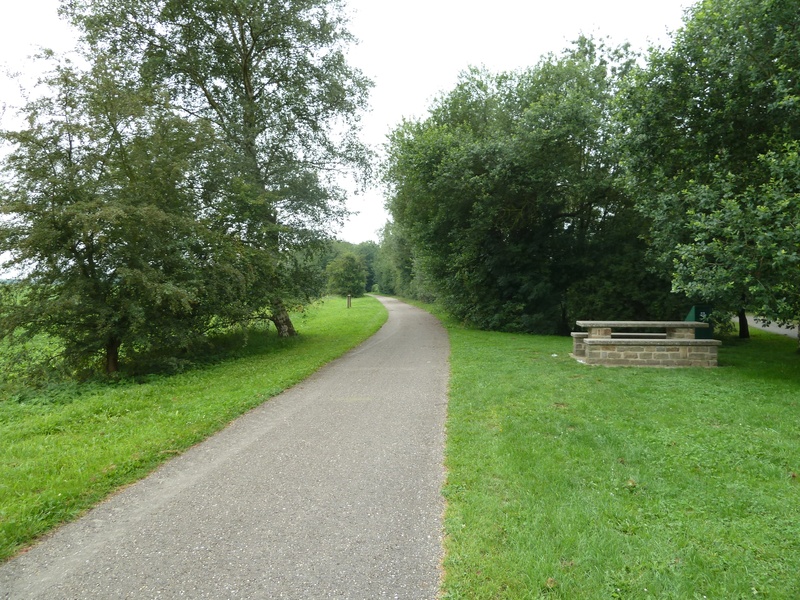
On the Line 147 RAVeL

Family
")
21,5 km
As you leave Perwez, you will go through an agricultural landscape for about fifteen kilometres before reaching the valley of the Petite Jette. Following a gentle slope, you will then reach the plateaux of the commune of Lincent.
The area around the Line 147 RAVeL is very open. The landscape encourages you to daydream. The RAVeL here reaches an altitude of 180 m. You are in Hesbaye du Nord on the edge of the orchards of Limburg.
If you carry on past Racour railway station, you will go into the commune of Landen in the province of Flemish Brabant.
Details
The route:
The route follows its own safe path along the Line 147 RAVeL.
Surface:
Smooth, asphalt.
Height difference:
Imperceptible incline
Signs:
Full directional signs are in place along the entire route.
Connections:
- Between Ramillies and Orp-le-Petit, the path shares the W2 regional route. In Orp-le-Petit, route W2 forks towards Hannut along a perfectly signposted connecting route.
- •After Racour railway station, you can get to Landen by continuing along Line 147. From Landen, you can also reach the Line 127 RAVeL towards Hannut. To do this, you simply follow the numbers of the nodal points (NP) along the cycling network in the province of Flemish Brabant: follow NP 19 and 22 to reach Landen and Line 127.
Warnings
Useful info
Start:
Perwez, rue de la station (N243), site of the former railway station.
Coordinates Lambert72 : X : 181301 m - Y : 146190 m
GPS coordinates: latitude : 50°37'31.88 N - longitude :04°48'40.04'' E
Access by car: car park on site.
Finish:
Former Racour station, at the end of the Rue de la station.
Coordinates Lambert72 : X : 197825 m - Y : 158671 m
GPS Coordinates: latitude: 50°44'11.76" N - longitude: 05°2'46.53" E
Go to Landen railway station and the centre of the town when you arrive: continue along the RAVeL as far as the end of the path laid out in the Landen industrial park. Turn right and then towards nodal point 53. After going under the tracks, turn right into Pepynstraat to the railway station and the centre.
Rest areas:
In Ramillies, at several points in the canton of Jodoigne and in Lincent where barbecues are set up just next to the railway station.
Guides/maps:
- RAVeL maps of the Province of Liege and Walloon Brabant published by the SPW. These maps, called ‘More RAVeL, more pleasure’, can be ordered free of charge by clicking here.
Around the route by bike:
- Cycling circuits in Brabant Hesbaye: http://www.hesbayebrabanconne.be/fr/circuits-velo-hesbaye-brabanconne.
Stage map