Find my route
De Trois-Ponts à Waimes (stage 1)
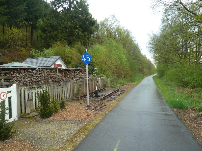
On the Line 45 RAVeL, the greenway of the Former Principality

Family
")
20,5 km
The history of these paths is linked to the historical crossroads between the Luxembourg, Prussian and Belgian railways. Each one contributed to the development of these lines. And it’s just as well.
The RAVeLs and cycling routes, which are proving ever more popular, find an oasis of green here for soft travel, tourism and the rediscovery of barely forgotten flavours.
You can explore the valleys of the Amblève and the Warche rivers from a different viewpoint, in particular by visiting Stavelot Abbey with its ‘Blancs Moussis’ (White Clad) carnival characters or shopping in old Malmedy, the heart of the ‘Cwarmé’ event during the carnival period.
Near Hottleux (La Hutte au loup or Wolf’s Hut!), you go past a sandstone quarry, reminding you that you are also in the land of the stone. At the end of this stage, the flowered village of Waimes warmly welcomes you to savour the local gastronomy.
Details
The route:
Your stage follows its own safe path along the Line 45 RAVeL.
Surface:
Smooth (mostly asphalt).
Height difference:
Ascent of 324 metres. Imperceptible incline. Slight, steady uphill slope to Waimes (gradient < 2%).
Signs:
Full directional signs are in place along the entire route.
Warnings
Useful info
Start:
Route de Trois-Ponts (N68) in Trois-Ponts. Coming from Stavelot, the entrances to the RAVeL and the car park are just before the two small tunnels leading to the Route de Coo (N633).
Coordinates Lambert 72 : X : 257220 m - Y : 119446 m
GPS coordinates: Latitude: 50°22'34.07'' N - Longitude: 5°52'34.36'' E
Access by train: when you come out of the Trois-Ponts railway station, follow rue de la Gare towards the centre. Then carry straight on along the Route de Coo (N633) towards Stavelot. After the bridge over the Amblève river, take the first right (N68) towards Stavelot. Once you have gone through two small tunnels, the entrance to the RAVeL is directly on your right. It goes up a fairly steep ramp.
Arrival:
Rue du Centre (N632) in Waimes.
Coordinates Lambert 72 : X : 273869 m - Y : 124217 m
GPS coordinates: Latitude: 50°24'56.65'' N - Longitude: 6°06'42.42'' E
Access by car: easy parking in the vicinity.
Guides/maps:
- RAVeL map of the Province of Liège published by the SPW. This map, called ‘More RAVeL, more pleasure’, can be ordered free of charge by clicking here.
- Map to a scale of 1/100,000 available from the ATEB detailing the route of the various sections of the RAVeL in the East Cantons.
Around the route by bike:
Stage map