Find my route
Boucle du Barrage de la Gileppe
Between dam and Westhertogenwald

Medium
")
15 km
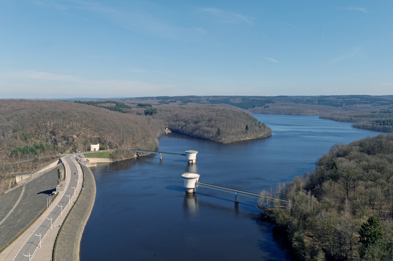
You are invited to take a trip through the forested area of Hertongenwald, known in French as the ‘forêt des Ducs’, on the slopes of the East Cantons of Belgium. The path around the artificial lake created when the dam was built between 1875 and 1878 reveals a landscape of softwood and deciduous trees. The views over the steep-sided valleys, the setting for many streams from the Fens plateau, will delight those who love peaceful atmospheres.
At the end of your hike, two panoramic lifts take you 77 metres above the dam for a well-deserved snack at the top of the Tower. From there, a last look over the region, with a 360° view, will leave you with an unforgettable memory of your day.
Details
The route:
The route partly follows its own path on the RAVeL. One-third of the circuit is on roads. At the end of the route, take care as you follow the N629 regional road for just over one kilometre.
Surface:
Smooth asphalt. Some uneven stretches.
Height difference:
Hilly, ascent of 221 metres.
Signs:
No signs.
Safety, precautions:
The route partly follows its own path. Particular care should be taken along the part on the road between the village of Herbiester and the Gileppe dam.
Warnings
Useful info
Start and finish:
Start from the beginning of the RAVeL, near the dam and the car park.
Coordinates Lambert 72 : X : 263160 m - Y : 142750 m
GPS coordinates: Latitude: 50°35'4.11" N - Longitude: 5°58'0.32 "E
Rest areas:
Rest areas can be found all along the path, some with shelters, usually on the site of old railway stations such as in Roetgen.
Guides/maps:
- RAVeL map of the Province of Hainaut published by the SPW. This map, called ‘More RAVeL, more pleasure’, can be ordered free of charge by clicking here.
- All documentation can be obtained via the ATEB website (https://www.ostbelgien.eu/fr). In particular, a map to a scale of 1/100,000 is available which gives details of the path followed by the Vennbahn and indicates the connections with other RAVeL routes as well as other connections to the German cycling route and greenways network (‘Radweg’).
Around the route by bike:
- VeloTour – Hautes Fagnes–Eifel nodal-points cycling route network: https://www.ostbelgien.eu/fr
Stage map