Find my route
De Beloeil à Onnezies (Honnelles) (stage 2)
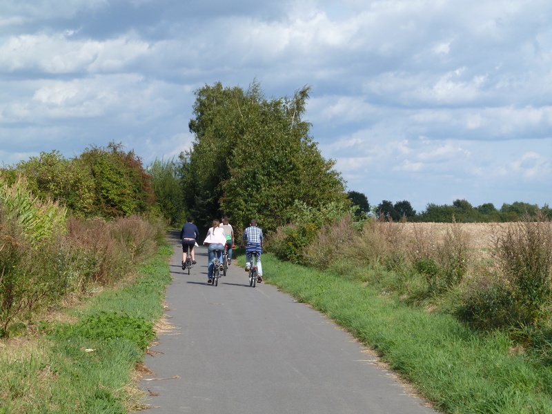
On the Canals RAVeL between Ath, Blaton, Pommeroeul and the Lines 98 and 98A

Family
")
38,5 km
This is a somewhat bewildering route that includes a French garden at a time when the English garden reigned supreme, a jumble of canals guarded by iguanodons and the green and hilly Borinage region where people come to relax.
Starting from Beloeil, you take the Blaton-Ath canal RAVeL towards Blaton. You go through the pretty little village of Ecacheries and the famous boiling fountain to reach Stambruges and the Mer de Sable nature reserve.
Via the Line 78A RAVeL and the Nimy-Blaton-Péronnes canal RAVeL, you then head towards Harchies and its nature reserve. The lakes here were created by mine collapses that occurred from the mid-1920s. So nature reasserted its rights… in the loveliest way. Other coal mines, not far away in Bernissart, also revealed 29 complete iguanodons in 1878.
This is the land of coal, the main raw material of the Borinage, especially in the Hauts-Pays area. It is a region well worth exploring which, far from the clichés and documentaries, can be surprisingly beautiful. Life in Hensies, Quiévrain, Dour and especially Honnelles is unexpectedly gentle. For that matter, the poet Verhaeren made a point of coming here every summer. Crossing alternately through undergrowth and landscapes on the RAVeL of Lines 98 and 98A, at the end of this route you arrive in Roisin, the old land of the vine.
Details
The route:
Your journey begins at the crossroads between rue du Docteur Ronflette and the Blaton-Ath canal RAVeL, which you follow on the left bank towards Stambruges.
At lock No 4, having gone under the motorway, you leave the canal, cross the bridge and go along rue de Condé to join the Line 78 RAVeL. You go past a sandpit in the woods, cross a canal and take the ramp on your right that leads to the RAVeL on the right bank of the Nimy-Blaton-Péronnes canal.
Along the edge of the canal, you turn right towards Harchies. You cross the Pommeroeul lock then fork right to join the Pommeroeul-Condé canal towards Hensies. Having gone under a road bridge, you leave the RAVeL by taking the first left, rue Hameau de la Neuville. You then follow a connecting route on minor roads.
At the first crossroads, you turn right into the Chemin du Trainage. You go underneath the motorway with the border post and then turn left into rue des Chiens, then right into rue Basse and carry straight on along rue Haute as far as the roundabout in the main square of Hensies.
At the roundabout, carry straight on along rue de Villers. Go past the cemetery. At the next crossroads, keep going straight on along the chaussée Brunehaut. You go past the railway bridge and then take the first right. You soon reach the Line 98 RAVeL, which you follow by turning left towards Dour. Take care when crossing the chaussée de Mons.
Just after the village of Elouges, you fork right on the Line 98A RAVeL towards Roisin and Bavay, a town in France and major Gallo-Roman crossroads.
Surface:
Mostly smooth (alternately asphalt and concrete).
Height difference:
Flat or imperceptible incline.
Signs:
Full directional signs with W1 identification panels are in place.
Safety, precautions:
Take care when leaving the locks where motor traffic is authorised, on the short connecting stretch through the village of Hensies and when crossing roads on the RAVeL.
Connections:
- Between Blaton and Harchies bridge, route shared with the W4 regional route. In Blaton, you can turn onto the W4 towards Péruwelz and Tournai. At Harchies bridge, you can turn onto the W4 towards Mons.
- In Elouges, you can turn onto the Line 98 RAVeL towards Mons.
Warnings
Useful info
Start:
Crossroads between rue du Docteur Ronflette and the Blaton-Ath canal RAVeL in Beloeil.
Coordinates Lambert 72 : X : 105811 m - Y : 137612 m
GPS coordinates: Latitude: 50°32'51.32'' N - Longitude: 3°44'42.90'' E
Access by car: A few parking spaces near the start.
Rest areas:
There are several rest areas along the way.
Guides/maps:
- RAVeL map of the Province of Hainaut published by the SPW. This map, called ‘More RAVeL, more pleasure’, can be ordered free of charge by clicking here.
- Map of East Wallonie picarde (Western Hainaut) by bike: wapishop.be.
Stage map