Find my route
De Hannut à Liège (stage 4)
On the minor roads of the Hesbaye and the Line 210 RAVeL

Expert
")
44,5 km
Starting from Hannut, an important place in the Duchy of Brabant during the Middle Ages, your route towards the city of the prince-bishops takes you through the pastoral landscapes of the Hesbaye.
In the village of Poucet you go past superb orchards, following a quiet route to the edge of the town of Waremme, the commercial and educational centre of the region, which has a series of waymarked cycling routes. Your ride continues on its way along very quiet roads through villages with charming names such as Fexhe-le-Haut-Clocher, where you can visit a craft chocolate maker.
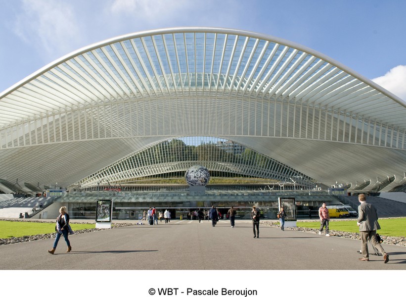
You enter the Principality of Liège through Awans, a bungee-jumping centre, and then Ans where you join the Line 210 RAVeL towards the prestigious Liège-Guillemins railway station, the work of architect Santiago Calatrava. The folklore, friendly people and districts that are lively both day and night make Liège, known as the Cité Ardente to reflect this, an unmissable stage along this route. Its historic centre, its many museums, the Carré district and the paths leading up to the Citadel, providing a spacious green area for walkers right in the centre of the city, will remain etched in your memory.
Details
The route:
Most of the route runs along roads that are quiet but currently not signposted/waymarked. Click here for a detailed description.
Surface:
Smooth (mostly asphalt).
Height difference:
Flat.
Signs:
Between Hannut and Waremme, there are not directional signs in place along the route. You can refer to the interactive map on our website, the RAVeL of the Province of Liège, download the detailed description as a PDF file or download the GPX file below to organise your trip as well as possible.
Between Waremme, Ans and Liège, full directional signs are in place along the entire route.
Safety, precautions:
Most of the stage runs along quiet minor roads with cycle paths here and there. Caution is needed when crossing the town of Waremme. As you enter Liège, you go along busier roads where you should take extra care.
Warnings
Useful info
Starting point:
Grand Place, Hannut.
Coordinates Lambert 72 : X : 200121 m - Y : 151524 m
GPS coordinates: Latitude: 50°40'19.79 "N - Longitude: 5° 4'40.18 "E
Access by car: parking possible near the starting point.
To reach the centre of Liège in peace and quiet from Liège-Guillemins railway station:
Leave Liège-Guillemins railway station behind you and head towards the Meuse along rue Paradis. When you reach the bottom of the footbridge spanning the Meuse, simply follow the current of the river and take the RAVeL along the quays. You will soon reach the city centre, which stands on the left bank of the Meuse.
Rest area:
Parc de la Boverie.
Guides/maps:
- RAVeL map of the Province of Liège published by the SPW. This map, called ‘More RAVeL, more pleasure’, can be ordered free of charge by clicking here.
Stage map