Find my route
De Tournai à Péruwelz (stage 2)
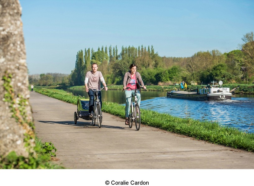
On the RAVeLs of the Scheldt and the Nimy-Blaton-Péronnes canal

Family
")
22 km
From Tournai, you go towards Antoing, where the river is used to carry the output from the limestone quarries to Ghent. It is also the start of a network of canals and riverboat centres such as Péruwelz, Bernissart and Saint-Ghislain. Places charged with history, inland waterways and lime kilns, but also modernity. This is what you will think about as you cover this stage.
Downstream of Tournai, you enter the heart of the Pays Blanc region, the land of cement and lime. Although there are still bursts of activity, the remains of this centuries-old occupation can still be seen here: strange architecture of the lime kilns along the RAVeL, cement dust clogging windows, etc.
You reach Antoing, a mixture of modernity and historical sites dear to the Ancien Régime. Fontenoy is here, the site of the battle of 1745 and the famous words said to have been spoken: “Gentlemen of England, you fire first...”.
As far as we are concerned, this episode should just remind us that Belgium has always been a battleground for the great nations on its borders. And that your travels through the beautiful region of Wallonia can be punctuated with places charged with history.
A little further on, in Péronnes, you leave the Scheldt and reach the Grand Large, an area of lakes, relaxation and leisure activities covering 45 ha.
You continue on the RAVeL as far as Péruwelz, a small town where water, green spaces and forest alternate. This is an entrance to the Plaines de l’Escaut nature reserve. The Forêt de Bonsecours with its forestry centre is here. Finally, it is a connecting route with the Gueules Noires greenway in Vieux-Condé (France).
Details
The route:
You follow the RAVeLs of the Scheldt and the Nimy-Claton-Péronnes canal.
Surface:
Smooth (alternately asphalt and concrete).
Height difference:
Flat or imperceptible incline.
Signs:
Full directional signs with W4 identification panels are in place.
Safety, precautions:
Watch out for the alternating safe paths and loading quays near industrial zones.
Connections:
- In Hollain, connection with the Line 88 RAVeL towards Antoing or Bléharies. Possibility of continuing along the Scheldt RAVeL towards France, as well.
- Between Péronnes and Callenelle, possibility of following a loop via the RAVeL of the historic Pommeroeul-Antoing canal.
- In Péruwelz, connection with the Line 92 RAVeL and, in future, with the Gueules Noires greenway towards Vieux-Condé (F).
Warnings
Useful info
Start:
Crossroads between the Pont de Fer and the Quai Notre-Dame in Tournai.
Coordinates Lambert 72 : X : 80542 m - Y : 144807 m
GPS coordinates: Latitude: 50°36'35.34" N - Longitude: 3°23'14.66" E
Access by train: Tournai railway station.
Rest areas:
There are several rest areas along the Nimy-Blaton-Péronnes canal between the Grand Large in Péronnes and Péruwelz.
Car parks along the route:
- Péronnes (lez-Antoing), rue du Rivage: 20 places, including for people with reduced mobility.
- Péronnes (lez-Antoing), rue du Large: 7 places, including for people with reduced mobility.
- Roucourt, rue de la Guerison, including for people with reduced mobility.
- Péruwelz, Quai de Paray-Vieille-Poste: 5 places, including for people with reduced mobility.
Guides/maps:
- RAVeL map of the Province of Hainaut published by the SPW. This map, called ‘More RAVeL, more pleasure’, can be ordered free of charge by clicking here.
- Maps of West and East Wallonie picarde (Western Hainault) by bike: wapishop.be.
Around the route by bike:
- Wallonie picarde (Western Hainaut) by bike: www.wapinature.be/-A-velo-.html.
- Hainaut by bike – Hainaut Rando routes: www.hainauttourisme.be/loisirs-et-activites/itineraires-thematiques/
Stage map