Find my route
De Lanaye (Visé) à Liège (stage 1)
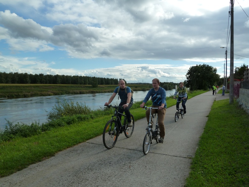
On the Meuse RAVeL

Family
")
24 km
This stage runs mainly along its own safe path, starting at the Lanaye lock complex. Thanks to the new wide lock, 9,000-tonne boats can now pass between the inland waterway networks of Belgium and the Netherlands.
On your right is the ‘tranchée de Caster’, a wide cut through the limestone at the foot of the Montagne Saint-Pierre nature reserve. On your left, the Frayères de Lanaye natural site is the perfect place to relax. It is worth mentioning that in May 1940, the German troops entered Belgium through this region. The marks of this invasion are still clear to see in the forts of Eben-Emael and Aubin-Neufchâteau.
After crossing the delightful village of Lanaye, you go through Visé, the city of the goose, where you can admire the Ferme du Temple, a farm built by the Templars in the 13th century.
The Albert canal RAVeL and then the Meuse RAVeL take you to Liège, which reveals its industrial, architectural and cultural heritage. Its folklore, the warmth of local people and its districts bustling with activity both day and night, reflected in its nickname, the Cité Ardente, make this an unmissable stage along your route. You will remember its historic centre, its many museums, the Carré district and the slopes of the Citadel, providing a spacious green area for walkers right in the centre of the city.
Details
The route:
This stage runs along the Canal Albert RAVeL and the Meuse RAVeL.
Surface:
Mostly smooth. Alternately asphalt and concrete.
Height difference:
Flat.
Signs:
Full directional signs with W7 identification panels are in place along the entire stage.
Warnings
Useful info
Start:
Lanaye lock, Rue Collinet 1 in Lanaye (Commune of Visé).
Coordinates Lambert 72: X: 243066 m - Y: 165805 m
GPS coordinates: Latitude: 50°47'42.90" N - Longitude: 5°41'19.87" E
Access by Train: Maastricht station (8.5 km away) or Visé station (9 km away).
Parking: Large car park at the start.
Rest area:
L’île Robinson in Visé (at the Visé harbour master's office, go briefly along the Meuse towards the Visé bridge. L’île Robinson leisure site is just after the Visé bridge).
Guides/maps:
- RAVeL map of the Province of Liège published by the SPW. This map, called ‘More RAVeL, more pleasure’, can be ordered free of charge by clicking here.
Around the route by bike:
- In Maastricht and in Visé, connection to the nodal-points cycling networks of the Lower Meuse, Belgian Limburg and Dutch Limburg.
- Two cycling loops of about 30 kilometres start from Visé: the Pear Tree ride and the Cherry Tree ride.
Stage map