Find my route
De Liège à Durbuy (stage 2)
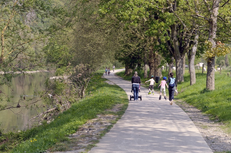
On the Ourthe RAVeL and connecting cycle paths

Expert
")
64 km
Starting from Liège, known as the Cité Ardente owing to its warm, welcoming, lively atmosphere, you can enjoy a breath of fresh air along the rural route that follows the curves of the Ourthe river. The RAVeL takes you as far as Comblain-la-Tour, a former jazz hot spot.
You will discover outstanding rocky massifs such as the Rochers-du-Bout-du-Monde or the Roche-aux-Faucons while flirting with the remains of the old Ourthe canal, a project that began in the early 19th century and was to link the Meuse to the Rhine via the eastern Ourthe, the Frayne, the Woltz, the Sûre and the Moselle. If you wish, you can stop in Esneux, Hamoir or Barvaux, all three tourist centres with dwellings typical of the region.
Witnesses of human activity past and present, locks of the old Ourthe canal, artistic events, architectural, geological and natural curiosities will delight dreamers and poets, taking you as far as Durbuy, the Pearl of the Ardennes, which is the final destination of this stage. Durbuy, considered to be the world’s smallest city, harbours a wealth of heritage with its old 17th- and 18th-century houses and its 11th-century feudal castle.
Details
The route:
The first part of the stage between Liège, Esneux and Comblain-la-Tour follows the Meuse and then the Ourth RAVeL along its own safe path. Between Comblain-la-Tour, Hamoir and Bomal, the RAVeL along the Ourthe river is due to be set out during the next four years. The route therefore includes some stretches along regional roads where the traffic is often fast. Between Bomal, Barvaux and Durbuy, you return to the Ourthe RAVeL on its own safe path.
Route description:
From the Saucy footbridge, you leave Liège via the RAVeL on the right bank of the Meuse. You go past the Palais des Congrès conference centre on your left and the Tour des Finances on your right.
When you cross through the Parc de la Boverie, a cycle-footbridge across the Meuse takes you to the monumental Liège-Guillemins railway station designed by the Spanish architect Santiago Calatrava. The W7 route, meanwhile, carries on through the Parc de la Boverie on the right bank of the Meuse to the confluence with the Ourthe. Here, at the Quai du Condroz, you take the RAVeL on the left bank of the Ourthe. You continue on the RAVeL along the Quai des Vennes. You then turn onto the Ourthe canal RAVeL for about 800 metres along the long quay of the same name. You then return to the RAVeL on the left bank of the Ourthe. The RAVeL soon becomes established between the railway line and the river.
A few kilometres further on, you go pass the Tilff football pitches. If you feel like some refreshments, you can reach the centre of the village via a footbridge over the Ourthe.
You continue along the RAVeL on the left bank of the Ourthe towards Mery. You leave the railway station on your right and walk along the edge of the Ourthe.
In Hony, there is a break in the RAVeL through the village. At the end of the RAVeL, take rue Trou Lina on your right. Turn right at the crossroads into rue du Centre. At the next crossroads, carry straight on along rue Chemin d’Enonck, a one-way street. Go underneath the railway tracks and continue straight on along rue de Fêchereux. When this reaches the Ourthe, the RAVeL is down below on your left. Cross the footbridge to join the RAVeL on the right bank of the Ourthe. Finally, a small country road will take you to the centre of Esneux. At the crossroads with traffic lights, cross the road and carry straight on to the car park in the town centre. Here you will find a rest area and a playground for children. The RAVeL starts again at the back of the car park, along the edge of the river.
After about three kilometres, just before Poulseur, you cross the Ourthe using a footbridge adjoining the railway bridge.
In Chanxhe, you go behind the football pitch. You then cross another footbridge adjoining the railway bridge over the Ourthe.
Going through Rivage is not easy. You have to pass in front of Rivage railway station and take rue du Barrage on your right which leads you along the edge of the river as far as a ramp leading to Rivage bridge. Cross the Ourthe again and carry straight on along rue de Liotte as far as the crossroads with the N633. Turn right and then immediately after the level crossing take the RAVeL to the left which leads you along the right bank of the Ourthe. There are no signs in place here.
The RAVeL leads you as far as the Comblain bridge. Cross the Ourthe. Then turn left onto the N654 for several hundred metres. The RAVeL starts again just before the first house on your left, behind the Centre de la Pierre (stone centre). Carry on to the end of the RAVeL at Hamoir.
In Hamoir, take the N831 towards Verlaine-sur-Ourthe and Durbuy. Upon leaving Hamoir, the N831 has a cycle path. On the long, straight stretch, leave the N831 towards Verlaine-sur-Ourthe. Follow the road that leads along the edge of the Ourthe. You will come to a railway bridge over the Ourthe. The short stretch of the RAVeL on the left bank of the Ourthe between the village of Sy and the Domaine de Palogne tourist and leisure park begins a little further on.
When you reach the Domaine de Palogne, cross the Ourthe via the footbridge. Take the small road to the Logne fortress. At the castle, turn right into rue de Saint-Cergue. This takes you to the N86, which you follow on your right as far as Bomal. In Bomal, turn right on the N806. Just after crossing the bridge over the Ourthe, a ramp on the left leads to the RAVeL along the river. Follow the RAVeL on the left bank of the Ourthe to Barvaux and Durbuy.
A detailed description in the form of a roadbook is available by clicking here.
Surface:
Smooth, alternately asphalt and concrete.
Height difference:
Flat or imperceptible incline between Liège and Hamoir. Two hills with gradients of 3 to 8% between Hamoir and Bomal. Flat or imperceptible incline between Bomal and Durbuy.
Signs:
Full directional signs with W7 identification panels are in place along the entire stage.
Safety, precautions:
Between Hamoir and Bomal the route mainly follows regional roads where the traffic is fast.
Connections:
- Stage shared with The Meuse by bike international route as far as the Quai du Condroz as you leave Liège in Angleur.
- In the Parc de la Boverie in Liège, you can join the W2 regional route. If you leave the W7 route by crossing the cycle-footbridge across the Meuse, you then follow the W2 route towards Waremme and Brussels.
- At the Quai du Condroz, you can turn onto the routes The Meuse by bike, EV3 and W6 towards Huy.
- From the Quai du Condroz to the footbridge over the Ourthe in Chênée, stage shared with routes EV3, W2 and W6. At the footbridge over the Ourthe in Chênée, routes EV3 and W2 turn towards the Line 38 RAVeL heading to Herve and Aachen while route W6 leads to Chaudfontaine.
Warnings
Useful info
Start:
Bottom of the Saucy footbridge in Liège, Quai Van Beneden, on the right bank of the Meuse.
Coordinates Lambert 72 : X : 235583 m - Y : 148525 m
GPS coordinates: Latitude: 50°38'27.87 "N - Longitude: 5°34'43.44 "E
Access by train: Liège-Guillemins Belgian railway station.
Rest area:
Parc de la Boverie, numerous rest areas along the Ourthe RAVeL: Tilff, Mery, Esneux, Hamoir, Bomal, Durbuy.
Guides/maps:
- RAVeL maps of the Provinces of Liège and Luxembourg, published by the SPW. These maps, called ‘More RAVeL, more pleasure’, can be ordered free of charge by clicking here.
Stage map