Find my route
De Dinant à Barvaux (Durbuy)(stage 3)
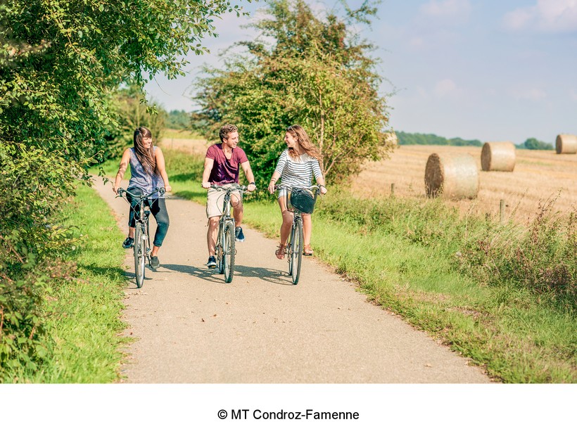
Sur le RAVeL de la Ligne 126, la dorsale du Pays de Famenne et le RAVeL de l'Ourthe

Medium
")
65 km
In the Meuse valley, the path follows a gentle incline for about 10 km alongside the charming Fonds de Leffe nature reserve between steep rocky hillsides. You head towards the Condroz plateau along quiet little roads.
You pass successively through the beautiful villages of Thynes and Sovet, characterised by limestone dwellings typical of the region. The route also gives you an opportunity to admire Leffe abbey, Chession castle and Lisogne mill.
Having left the town of Ciney behind, you take the Line 126 RAVeL through the Condroz. Here you are at the heart of the ‘valley of flavours’, where cyclists are welcomed by establishments displaying the ‘Bikes Welcome’ label.
In Hamois you can admire the Château Pickeim and the Château de Buresse. From Havelange, you cross grasslands where the famous ‘blanc bleu belge’ (Belgian Blue) cattle are raised.
Throughout your journey you can stop off at old railway stations where interpretative panels in the form of old train seats immerse you in the history of the region’s railway.
In Les Avins, you leave the Line 126 RAVeL and you carry on through the typical Condroz villages of Bois, Chardeneux and Septon. You wander through small woods, fields of crops and grazing land in the pastoral Ourthe valley. Seated on your trusty two-wheeled steed, you reach Durbuy, considered to be the world’s smallest town, harbours a wealth of heritage with its old 17th- and 18th-century houses and its 11th-century feudal castle.
The Ourthe RAVeL leads you finally to Barvaux, a tourist centre with dwellings typical of the region, well known for its summer maze.
Details
The route:
Having crossed Bouvignes lock and taken the N948 road for a few hundred metres following the signs (panels with green background), you turn right along a secondary road towards Thynes, Sovet and Ciney.
After Ciney, you follow the own safe path on the Line 126 RAVeL
In Les Avins, you leave the Line 126 RAVeL and you follow quiet little roads until Durbuy, where the traffic is usually light.
Between Durbuy and Barvaux, you follow the own safe path on the Ourthe RAVeL.
Surface:
Smooth (concrete or asphalt).
Height difference:
Hilly route with moderate inclines, usually less than 3%.
Signs:
Directional signs are in place along the entire route.
Safety, precautions:
This stage consists of stretches along quiet roads but caution is nevertheless required.
Connections:
- Between Dinant and Ciney, common route with EuroVelo 5.
- In Durbuy, you can join the Regional Route W7.
Warnings
Useful info
Start:
Bouvignes-sur-Meuse lock, avenue Colonel Cadoux in Dinant (left bank of the Meuse).
Coordinates Lambert 72 : X : 188173 m - Y : 106400 m
GPS coordinates: Latitude: 50°16'2.64'' N - Longitude: 4°54'15.04'' E
To reach the start from the centre of Dinant: cross the Dinant bridge and follow the Meuse along the left bank for about one kilometre as far as the Bouvignes lock
Access by train: Dinant Belgian railway station.
Rest areas:
- Just before reaching the village of Thynes.
- Durbuy, Barvaux.
Guides/maps:
- RAVeL maps of the Provinces of Namur, Liège and Luxembourg published by the SPW. These maps, called ‘More RAVeL, more pleasure’, can be ordered free of charge via the RAVeL website by clicking here.
- Map of the Pays de Famenne region by bike (nodal points), distributed by the Tourist Offices.
Around the route by bike:
- Bike rides in the valley of flavours: www.valleesdessaveurs.be
- Pays de Famenne region by bike: www.famenne-a-velo.be
Stage map