Find my route
De Momignies à Mariembourg (Couvin)(stage 1)
On the Line 156 RAVeL

Medium
")
31 km
Soon in English.
Au départ de la ville de Momignies, frontalière à 3 départements français (du Nord, de l’Aisne et des Ardennes), cette étape sur le RAVeL de la Ligne 156 transite par le cœur de la cité médiévale et principautaire de Chimay pour se terminer à la si caractéristique ville de Mariembourg dessinée par Vauban.
C’est entre schiste et calcaire, entre Famenne et Calestienne, entre plaine et relief, que vous traversez de splendides paysages dessinés par une géologie capricieuse. Celle-ci n’a-t-elle d’ailleurs pas contraint notre ancienne voie ferrée à franchir l’Eau Blanche par cet impressionnant viaduc de Blaimont qui la domine de ses huit arches et ses 27 mètres de haut ?
Soon in English.
Les nombreuses voiries locales croisées chemin faisant vous invitent à la flânerie vers les curiosités toutes proches : l’étang de Virelles et sa réserve naturelle ornithologique si riche ; Lompret, l’un des plus beaux villages de Wallonie; l’imposant château de Boussu-en-Fagne sorti droit du Moyen-âge ; le Chemin de Fer à Vapeur des Trois Vallées pour ne citer qu’eux.
Et le «dopage» aux bières locales, en quantité modérée cela s’entend, est autorisé pour avaler ce trajet constitué de bois, campagnes, étangs qui ne peuvent que vous ravir. La région de la Botte du Hainaut semble être, à l’instar de sa cuisine, une anguille insaisissable.
Details
The route:
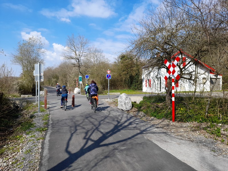
The route follows its own safe path along the Line 156 RAVeL.
We advise you to take the RAVeL close to the old Momignies railway station, near the carriage known as ‘de la Honte’ (of Shame). This carriage took Canadian soldiers captured in 1942 during the aborted Dieppe landing to Germany. It remained at a standstill under a blazing sun for about twelve hours.
After a short section in a forest with an arboretum, this path goes through the villages of Seloignes, Villers-la-Tour and Saint-Remy. In Chimay, near the hospital, it joins up directly with the Line 109/2 RAVeL. The urban stretch in Chimay laid out and the RAVeL takes you to Virelles, Aublain, Boussu-en-Fagne and Mariembourg industrial zone (N5).
The RAVeL currently ends just before the N5. To reach the start of the second stage, you have to go up rue Véroffe along the N5, then take the 2 roundabouts and the bridge that crosses over the N5. The Chaussée de Philipeville / N539 and rue d'Arschot then lead you to the central square of Mariembourg.
Surface:
Smooth (asphalt).
Height difference:
Imperceptible incline.
Signs:
Full directional signs are in place along the entire route until N5 in Mariembourg.
Connections:
- Further to a partnership with our French friends in the Nord department, an 18-kilometre cross-border connecting route called the ‘Avesnois cycling route’ has been signposted along quiet roads from Momignies.
In Momignies, the Avesnois cycling route, and therefore the EV3, heads south towards Anor and the ‘Hirson forest greenway’ which leads to Hirson.
Heading north, it forms the connection between the Line 156 RAVeL near the old Momignies railway station and the start of the Avesnois greenway in Glageon-Trélon. By following this connecting route and the Avesnois greenway, you can reach Maubeuge in peace and quiet, and carry on towards Erquelinnes along the Sambre greenway. Here, you can choose whether to go to Binche via the Line 108 RAVeL or to Thuin by continuing along the Sambre towpath. Once you reach Thuin, simply follow the Line 109/2 RAVeL to reach Chimay and finally Momignies. A loop of about 120 km made up primarily of greenways thus leads through the cross-border region of the Val de Sambre, the Thudinie region, the Botte du Hainaut and Avesnois.
Note that this loop is supplemented by the Lakes cycling route which links the Eau-d'Heure lakes and Val-Joly lake in France, passing through the communes of Froidchapelle and Sivry-Rance.
The Avesnois Greenway and the Sambre RAVeL are part of the EuroVelo 3 cycling route.
- In Chimay, connection to the Line 109/2 RAVeL, part of the W3 regional route towards Thuin. Line 109/2 leads on the one hand to the Eau d'Heure lakes RAVeL via Froidchapelle and the Lakes cycling route and on the other to the Sambre RAVeL.
Warnings
Useful info
Start:
Place de la Gare in Momignies.
Coordinates Lambert 72 : X : 135290 m - Y : 79460 m
GPS coordinates: Latitude: 50°01'34.52'' N - Longitude: 4°09'48.39'' E
Access by car : large car park next to the start.
Guides/maps:
- RAVeL map of the Province of Hainaut published by the SPW. This map, called ‘More RAVeL, more pleasure’, can be ordered free of charge by clicking here.
Around the route by bike:
- Hainaut by bike – Hainaut Rando routes.
- Nodal-points network in Hainaut.
Stage map