Find my route
De Raeren à Montjoie/Monschau (D) (stage 1)
On the Line 48 RAVeL

Family
")
27 km
The Line 48 RAVeL follows a permanent curve, starting at the site of the old Raeren railway station.
Having crossed the woods in the commune of Raeren, the Line 48 RAVeL - Vennbahn passes back and forth from one country to the other as nowhere else. One moment it is in Germany, the next in Belgium. The particular feature of the Line 48 RAVeL is that you are always in Belgium, even though the land on either side of the path is often in Germany. All along the way you will come across remains of the railway network, silent witnesses of a glorious past.
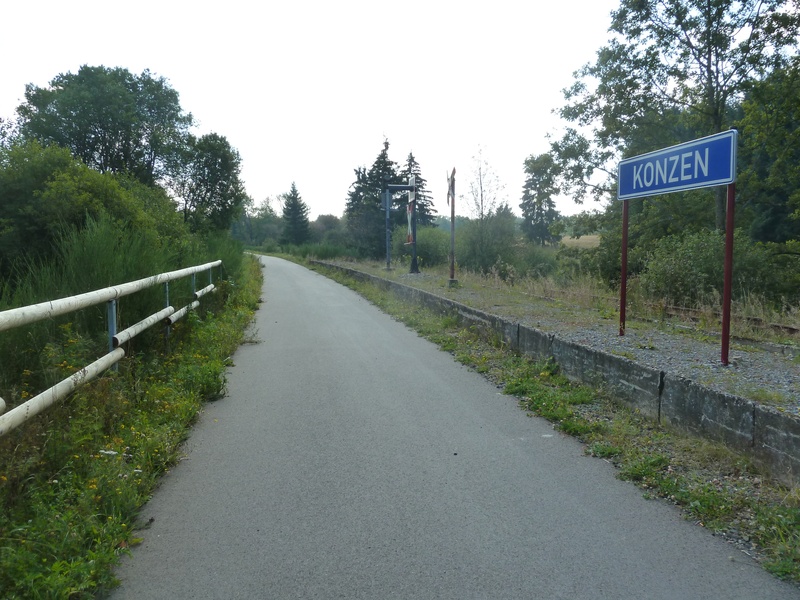
After Roetgen, the ‘gateway to the Eifel’, the forest is not as dense and heading towards Lammersdorf and Konzen, the landscape reminds some people of Switzerland. Overwhelmed by all these impressions, you reach the old cloth town of Montjoie/Monschau with its many magnificently preserved half-timbered houses.
Details
The route:
From the start in Raeren, the entire stage follows the Line 48 RAVeL - Vennbahn along its own path, apart from the connecting section to reach the centre of Montjoie.
Surface:
Smooth asphalt except in Paustenbach for three kilometres where the surface is compacted gravel for environmental reasons.
Height difference:
Flat or imperceptible incline (max. 1.7%).
Signs:
The entire route is marked by specific directional signs (‘Line 48 RAVeL - Vennbahn’).
Warnings
Useful info
Start:
Line 48 - Vennbahn car park near the old Raeren railway station, at the top end of Langenbend.
Coordinates Lambert 72 : X : 274271 m - Y : 151920 m
GPS coordinates: Latitude: 50°39'52 '' N - Longitude: 06°07'37 '' E
Access by car: Via Bahnhofstraße/Langenbend (RAVeL L48 – Vennbahn signs for cyclists). After 500 metres on Langenbend, the incline comes to an end, crossroads with the Vennbahn, parking area and information panels with map and resources. Take the Vennbahn to the right (towards the old signal box).
Access by train: The start in Raeren can be reached from Eupen railway station, the nearest station which is approximately ten kilometres away. The connection is signposted.
Finish:
Site of the old Montjoie/ Monschau railway station (D).
Coordinates Lambert 72 : X : 282147 m - Y : 141023 m
GPS coordinates : Latitude : 50°33'54 '' N - Longitude :06°14'02 '' E
Go to the centre of the town upon arriving: If you wish to go to the centre of Montjoie from the Vennbahn, find and follow the signs below (not immediately visible). By cycling along the main road for three kilometres (or 1.5 km on foot along a pleasant, steep downhill path), you reach the historic centre (Altstadt).
Rest areas:
Rest areas can be found all along the path, some with shelters, usually on the site of old railway stations such as in Roetgen.
Guides/maps:
- RAVeL map of the Province of Liège published by the SPW. This map, called ‘More RAVeL, more pleasure’, can be ordered free of charge by clicking here.
- All documentation can be obtained via the ATEB website (http://www.eastbelgium.com/fr/). In particular, a map to a scale of 1/100,000 is available which gives details of the path followed by the Vennbahn and indicates the connections with other RAVeL routes as well as other connections to the German cycling route and greenways network (Radweg).
Around the route by bike:
- VeloTour – Hautes Fagnes – Eifel nodal-points cycling route network: https://www.ostbelgien.eu/fr
- A number of loops use part of the route. These loops are included in a box set called ‘Vennbahn Plus’ which contains an illustrated map of the Vennbahn and a leaflet for each loop with a detailed map and tourist information. See https://www.ostbelgien.eu/fr
Variant:
Alternatively, you can start the stage in the German city of Aix-la-Chapelle (Aachen), where the Vennbahn begins, 17 kilometres from the border. In this case, the stage is 45 kilometres long.
Starting point in Aachen for the variant: See Vennbahn.
Access to the start of the variant: See Vennbahn.
You go through Aachen-Brand, Kornelimünster, Walheim and Schmithof. After 17 kilometres in Germany, you reach the Belgian border and enter Wallonia. The first stage starts in Raeren, two kilometres further on.
Stage map