Find my route
De Momignies à Mariembourg (Couvin)(stage 1)
On the Line 156 RAVeL – A short tour in Thiérache

Family
")
31 km
Between an arboretum, an abbey and a world famous principality, a leading bird sanctuary, a chronicler, a blockbuster and more.
The Botte du Hainaut region may seem somewhat elusive.
Together with the Avesnois greenway, the RAVeL of the Sambre and Line 109/2, Line 156 forms a cross-border loop stretching about 120 km and linking Maubeuge, Erquelinnes, Thuin, Chimay, Momignies and Glageon-Trélon.
In the end, the Botte du Hainaut is not cut off !
Details
The route:
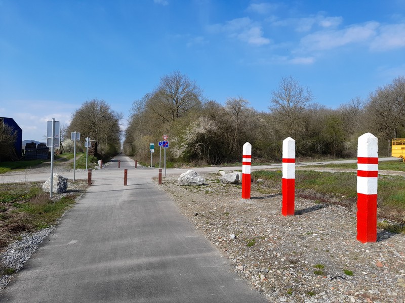
The route follows its own safe path along the Line 156 RAVeL.
We advise you to take the RAVeL close to the old Momignies railway station, near the carriage known as ‘de la Honte’ (of Shame). This carriage took Canadian soldiers captured in 1942 during the aborted Dieppe landing to Germany. It remained at a standstill under a blazing sun for about twelve hours.
After a short section in a forest with an arboretum, this path goes through the villages of Seloignes, Villers-la-Tour and Saint-Remy. In Chimay, near the hospital, it joins up directly with the Line 109/2 RAVeL. The urban stretch in Chimay laid out and the RAVeL takes you to Virelles, Aublain, Boussu-en-Fagne and Mariembourg industrial zone (N5). It is to be extended as far as Mariembourg station and the Meuse valley.
Surface:
Smooth (asphalt).
Height difference:
Imperceptible incline.
Signs:
Full directional signs are in place along the entire route.
Connections:
- Further to a partnership with our French friends in the Nord department, an 18-kilometre cross-border connecting route called the ‘Avesnois cycling route’ has been signposted along quiet roads from Momignies.
In Momignies, the Avesnois cycling route, and therefore the EV3, heads south towards Anor and the ‘Hirson forest greenway’ which leads to Hirson.
Heading north, it forms the connection between the Line 156 RAVeL near the old Momignies railway station and the start of the Avesnois greenway in Glageon-Trélon. By following this connecting route and the Avesnois greenway, you can reach Maubeuge in peace and quiet, and carry on towards Erquelinnes along the Sambre greenway. Here, you can choose whether to go to Binche via the Line 108 RAVeL or to Thuin by continuing along the Sambre towpath. Once you reach Thuin, simply follow the Line 109/2 RAVeL to reach Chimay and finally Momignies. A loop of about 120 km made up primarily of greenways thus leads through the cross-border region of the Val de Sambre, the Thudinie region, the Botte du Hainaut and Avesnois.
Note that this loop is supplemented by the Lakes cycling route which links the Eau-d'Heure lakes and Val-Joly lake in France, passing through the communes of Froidchapelle and Sivry-Rance.
The Avesnois Greenway and the Sambre RAVeL are part of the EuroVelo 3 cycling route.
- In Chimay, connection to the Line 109/2 RAVeL, part of the W3 regional route towards Thuin. Line 109/2 leads on the one hand to the Eau d'Heure lakes RAVeL via Froidchapelle and the Lakes cycling route and on the other to the Sambre RAVeL.
Warnings
Useful info
Start:
Place de la Gare in Momignies.
Coordinates Lambert 72 : X : 135290 m - Y : 79460 m
GPS coordinates: Latitude: 50°01'34.52'' N - Longitude: 4°09'48.39'' E
Access by car : large car park next to the start.
Finish:
Place Léopold Roger à Mariembourg (Couvin).
Coordinates Lambert 72 : X : 161105 m - Y : 87186 m
GPS coordinates: Latitude: Latitude : 50°05'44.87'' N - Longitude : 4°31'26.18'' E
Guides/maps:
- RAVeL map of the Province of Hainaut published by the SPW. This map, called ‘More RAVeL, more pleasure’, can be ordered free of charge by clicking here.
Around the route by bike:
- Hainaut by bike – Hainaut Rando routes.
- Nodal-points network in Hainaut.
Stage map