Find my route
De La Louvière à Charleroi (stage 5)
On the RAVeLs of the Canal du Centre (historique), the Charleroi-Brussels canal and La Houillère (Line 119)

Family
")
45 km
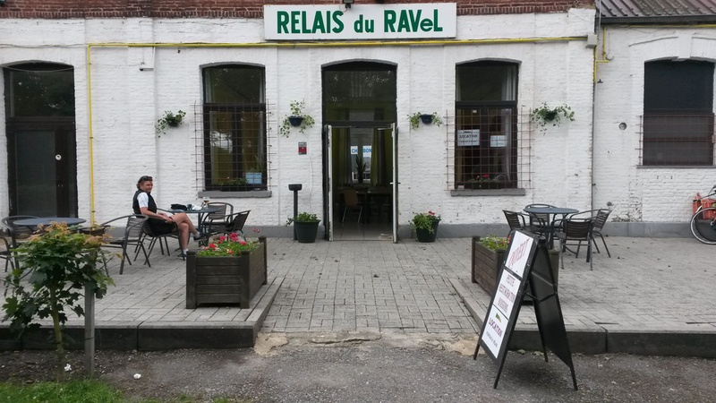
Canal water? There’s more to it than that! The construction of a RAVeL also involves civic initiatives! And welcoming spaces for relaxation!
Inland waterway transport between major cities? Definitely, but which demonstrates over and over again the industrial side - in the true sense of the term - of a region. The side that shows and reveals human know-how and inventiveness.
And above all, through the people you meet along the way, that shows big hearts as soon as they start talking about their region.
We follow the Canal du Centre historique to join the wide Canal du Centre. This will take you towards Châtelet and Charleroi along the Charleroi-Brussels canal and towards a RAVeL that is particularly typical and emblematic of the region: La Houillère RAVeL (Line 119).
Details
The route:
This stage follows its own path on the RAVeLs of the Canal du Centre historique, then the Canal du Centre, the Charleroi-Brussels canal and finally Line 119 - La Houillère.
Surface:
Mostly smooth (alternately asphalt and concrete).
Height difference:
Flat or imperceptible incline.
Signs:
Directional signs with W4 identification panels are in place.
Warnings
Useful info
Start:
Under the bridge on the chaussée Houdart (N535) in La Louvière, along the RAVeL on the right bank of the Canal du Centre historique.
Coordinates Lambert 72 : X : 135807 m - Y : 130079 m
GPS coordinates: Latitude: 50°28'52.88" N - Longitude: 4°10'07.56" E
Access by Train: SNCB railway station of La Louvière.
Guides/maps:
- RAVeL map of the Province of Hainaut published by the SPW. This map, called ‘More RAVeL, more pleasure’, can be ordered free of charge by clicking here.
Around the route by bike:
- Hainaut by bike – Hainaut Rando routes: http://www.hainauttourisme.be/loisirs-et-activites/itineraires-thematiques/
Stage map